Geochronology/Archaeology
Archaeology "studies human cultures through the recovery, documentation and analysis of material remains and environmental data, including architecture, artifacts, ecofacts, human remains, and landscapes."[1]

It is the study of human activity in the past, primarily through the recovery and analysis of the material culture and environmental data that they have left behind, which includes artifacts, architecture, biofacts and cultural landscapes (the archaeological record).
Because archaeology employs a wide range of different procedures, it can be considered to be both a science and a humanity.[2]
Archaeology studies human history from the development of the first stone tools in eastern Africa 3.4 million years ago up until recent decades.[3] (Archaeology does not include the discipline of paleontology.) It is of most importance for learning about prehistoric societies, when there are no written records for historians to study, making up over 99% of total human history, from the Palaeolithic until the advent of literacy in any given society.[2]
Theoretical archaeology
edit
Def. the "period of time that has already happened"[4] is called the past.
Def. the "study of the past through material remains"[5] is called archaeology, or archeology.
Entities
edit
"[D]ominant groups create and control the meanings and uses of material culture. If other groups wish to be understood by the dominant group, they must express themselves through the goods controlled by the dominant group."[6]
"But, the privilege afforded a certain dominant group of 'normal' archaeologists in terms of their ways of constructing the past influences all aspects of archaeological practice."[7]
"However, some answers to these questions may emerge from a consideration of the dominant group, that is, the five institutions whose scholars published the most articles in the two periodicals."[8]
Landscape archaeology
edit
Def. an assemblage of surfaces that are a portion of land, region, or territory, observable in its entirety is called a landscape.
Landscape comprises the visible features of an area of [terrestrial ecoregion] land, including the physical elements of landforms such as (ice-capped) mountains, hills, water bodies such as rivers, lakes, ponds and the sea, living elements of land cover including indigenous vegetation, human elements including different forms of land use, buildings and structures, and transitory elements such as lighting and weather conditions.
Landscape archaeology is the study of the ways in which people in the past constructed and used the environment around them. Landscape archaeology is inherently multidisciplinary in its approach to the study of culture, and is used by both pre-historical, classic, and historic archaeologists. The key feature that distinguishes landscape archaeology from other archaeological approaches to sites is that there is an explicit emphasis on the study of the relationships between material culture, human alteration of land/cultural modifications to landscape, and the natural environment.
Sources
edit
Archaeological field survey is the method by which archaeologists (often landscape archaeologists) search for archaeological sites and collect information about the location, distribution and organization of past human cultures across a large area (e.g. typically in excess of one hectare, and often in excess of many km2).
Surveys are conducted to search for particular archaeological sites or kinds of sites, to detect patterns in the distribution of material culture over regions, to make generalizations or test hypotheses about past cultures, and to assess the risks that development projects will have adverse impacts on archaeological heritage.[9]
The surveys may be: (a) intrusive or non-intrusive, depending on the needs of the survey team (and the risk of destroying archaeological evidence if intrusive methods are used) and; (b) extensive or intensive, depending on the types of research questions being asked of the landscape in question. Surveys can be a practical way to decide whether or not to carry out an excavation (as a way of recording the basic details of a possible site), but may also be ends in themselves, as they produce important information about past human activities in a regional context.
Excavation is the exposure, processing and recording of archaeological remains. An excavation site or "dig" is a site being studied.
Objects
edit


Def. an "object, such as a tool, weapon or ornament, [ceramics or pottery,] structure or finding in an experiment or investigation ... made or shaped by some agent or intelligence, ... [as] a result of external action, the test arrangement, or an experimental error ... rather than an inherent element"[10] is called an artifact, or artefact.
In June 2014, the Precolumbian Chiefdom Settlements with Stone Spheres of the Diquis was added to the UNESCO list of World Heritage Sites.[11]
The spheres range in size from a few centimetres to over 2 metres (6.6 ft) in diameter, and weigh up to 15 tons.[12] Most are sculpted from gabbro.[12]
The culture of the people who made them disappeared after the Spanish conquest.[13]
The first scientific investigation of the spheres was undertaken shortly after their discovery and published in 1943 in American Antiquity, attracting the attention of Samuel Kirkland Lothrop[14] of the Peabody Museum of Archaeology and Ethnology at Harvard University.[15] In 1948, he and his wife attempted to excavate an unrelated archaeological site in the northern region of Costa Rica.[16] In San José he met Doris Stone, who directed the group toward the Diquís Delta region in the southwest ("Valle de Diquís" refers to the valley of the lower Río Grande de Térraba, including the Osa Canton towns of Puerto Cortés, Palmar Norte, and Sierpe.[17]
The Dropa stones or discs may be a series of at least 716 circular stone discs, dating back 12,000 years, on which tiny hieroglyph-like markings may be found.[18][19] Each disc is claimed to measure up to 1 foot (30 cm) in diameter and carry two grooves, originating from a hole in their center, in the form of a double spiral.[20]
Coppers
edit
In "Serbia [are] the oldest copper implements in the world. Some 7000 years ago, tradesmen of great wealth flourished on the Balkan peninsula."[21]
"The soil around Plonik is rich in copper - the metal in a pure state lays often directly at the surface."[22]
The so-called "copper-violets" "are related to the Alpine violets, which we know in Germany from flower pots. But they grow only in a soil with a very high copper content. There - where the soil is too poisonous for the other plants, they blossom in wide carpets - and in so doing point to the presence of copper."[22]
In "the late stone age people picked up the beautiful stones. For instance, malachite. The green-hued mineral belongs to the class of carbonates. Copper content: 57 percent. Our ancestors made experiments with different stones over the fire. From there, it was only a small step to jewels and to more practical objects."[21]
On "the Black Sea Coast in today's Bulgaria, there flourished a prosperous, big city, quite close to today's Varna. Archaeologists have found the cemetary of this settlement. The graves were loaded with treasures: jewels - mostly gold, but also copper - sea shells from the Aegean and tools made of types of stone which must have come from far away."[21]
"In the 5. Millennium BC people lived there in complex, centralized settlements of up to a thousand inhabitants. They invented a new ceramic oven with two chambers which was remarkably well suited to the extraction of metal. We must strongly surmise that there existed relations between the Balkans and Northern Mesopotamia."[21]
"An enormous fire unleashed itself around 5000 BC in the city [of Plonik]. The earth carbonized. The houses collapsed and buried all the possessions of the inhabitants under their walls. When the flame died down, the city had ceased to exist."[21]
Tools
edit
In "the deep Southeast of Europe, near today's village of Plonik in Serbia, there existed 7000 years ago a major city. Its inhabitants lived in closely assembled huts and they melted copper to make jewels, tools and weapons."[21]
"The age of the oldest pieces which they have found up to now in the settlement is up to 7300 years. That's a good 800 years older as any other copper implements which have been found anywhere on Earth to this day."[21]
Weapons
edit
"The people of the Balkan peninsula had a good knowledge of how they could create jewels, tools and weapons out of earth with a high copper content."[21]
"In Plonik, excavators found hatchets of copper. And weapons: axes and maces. With them a new area began. The stone age was gone, the copper age - chalcolithic - had begun."[21]
Jewelry
edit.jpg)
"From one grave, the excavator dug 1,516 K of gold jewelry. This is more gold than has been found in all the rest of the world for this particular epoch."[21]
Materials
edit
"In order to interpret archaeological ceramic assemblages in terms of social identities, a method was developed [that] consists in sorting the potsherds according to, successively, technical, techno-petrographic and morpho-stylistic criteria."[23]
Heritage management
edit.jpg)
"Rare, though, is the country where ethnic groups balance each other in terms of numbers, wealth or political influence and, consequently, it is not uncommon for the dominant group to use its power to push its own heritage to the fore, minimizing or denying the significance of subordinate groups as it crafts a national identity in its own image."[24]
Historical archaeology
edit,_1973_(2144044691).jpg)
Historical archaeology is a form of archaeology dealing with places, things, and issues from the past or present when written records and oral traditions can inform and contextualize cultural material. These records can both complement and conflict with the archaeological evidence found at a particular site. Studies focus on literate, historical-period societies as opposed to non-literate, prehistoric societies. While they may not have generated the records, the lives of people for whom there was little need for written records, such as the working class, slaves, indentured labourers, and children but who live in the historical period can also be the subject of study. The sites are found on land and underwater. Industrial archaeology, unless practiced at industrial sites from the prehistoric era, is a form of historical archaeology concentrating on the remains and products of industry and the Industrial era.
Maya civilization
edit
In the image on the right, dense forest surrounds the city center of this Classic-era Maya site (top) Tikal. Laser mapping of the same view (bottom) reveals structures and causeways hidden by the jungle.
"Lidar (a type of airborne laser scanning) provides a powerful technique for three-dimensional mapping of topographic features."[25]
"Lowland Maya civilization flourished from 1000 BCE to 1500 CE in and around the Yucatan Peninsula."[25]
"In 2016, the Pacunam Lidar Initiative (PLI) undertook the largest lidar survey to date of the Maya region, mapping 2144 km2 of the Maya Biosphere Reserve in Guatemala."[25]
"Analysis identified 61,480 ancient structures in the survey region, resulting in a density of 29 structures/km2. Controlling for a number of complex variables, we estimate an average density of ~80 to 120 persons/km2 at the height of the Late Classic period (650 to 800 CE). Extrapolation of this settlement density to the entire 95,000 km2 of the central lowlands produces a population range of 7 million to 11 million."[25]
"Settlement distribution is not homogeneous, however; we found evidence of (i) rural areas with low overall density, (ii) periurban zones with small urban centers and dispersed populations, and (iii) urban zones where a single, large city integrated a wider population."[25]
"The PLI survey revealed a landscape heavily modified for intensive agriculture, necessary to sustain populations on this scale. Lidar shows field systems in the low-lying wetlands and terraces in the upland areas. The scale of wetland systems and their association with dense populations suggest centralized planning, whereas upland terraces cluster around residences, implying local management. Analysis identified 362 km2 of deliberately modified agricultural terrain and another 952 km2 of unmodified uplands for potential swidden use. Approximately 106 km of causeways within and between sites constitute evidence of inter- and intracommunity connectivity. In contrast, sizable defensive features point to societal disconnection and large-scale conflict."[25]
“The new lidar data show that interconnected Maya cities go back to at least 300 B.C.”[26]
The largest structure in the lidar image on the lower right is the Mayan temple at Tikal. The second image down on the right shows the Mayan temple at Tikal from the front.
Prehistory
edit
The prehistory period dates from around 7 x 10⁶ b2k to about 7,000 b2k.
Def. the "history of human culture prior to written records"[27] is called prehistory.
21st Century
edit"During an underwater expedition in 2000, divers saw a large stone head emerge from the murky dark waters [over Heracleion]. It was the head of the god Hapi, the personification of the Nile’s annual flood."[28]
Heracleion, also known by its Egyptian name Thonis,[29] and sometimes called Thonis-Heracleion, was an ancient Egyptian city located near the Canopic Mouth of the Nile, about 32 km northeast of Alexandria. Its ruins are located in Abu Qir Bay, currently 2.5 km off the coast, under 10 m (30 ft) of water.[30] A stele found on the site indicates that it was one single city known by both its Egyptian and Greek names.[31]
20th Century
edit
"In 1933 British RAF Group-Captain Cull was flying his plane over Aboukir, a Royal Air Force base east of Alexandria in Egypt, when he glimpsed something in the water below him. From his vantage point, Cull could make out the outlines of structures beneath the water. Unbeknownst to him, Cull had located Heracleion, an important ancient Egyptian city that had lain hidden beneath the water for nearly 1500 years."[28]
Heracleion is located at 31°18'15"N 30°06'02"E.
"According to legend, this lost metropolis had hosted its namesake, Heracles, and lovers Paris and Helen before they fled to Troy. Cleopatra, Egypt’s most famous queen, had even been crowned in one of the temples there."[28]
"Before its discovery, Heracleion (which was also known in the ancient world by its Egyptian name, Thonis) was almost the stuff of mythology. Though it is now buried several miles off the coast, Thonis-Heracleion was once a thriving port city."[28]
The ruins submerged in the sea were located and explored by the French underwater archaeologist Franck Goddio in 1999, after a five-year search.[32]
19th Century
edit
The Covered Bridge on the right was built in 1867 near the town of Cedarburg, Wisconsin.
"In 1866 Mahmoud Bey El-Falaki, the official astronomer to the Viceroy of Egypt, had published a map that located the nearby ancient town of [...] Canopus on the edge of the coastline."[28]
18th Century
edit
Taken from the observation platform at the top of the Jantar Mantar, the image on the right shows smaller architectural sundials. The Jantar Mantar is a collection of architectural astronomical instruments, built by Maharaja Jai Singh II at his then new capital of Jaipur between 1727 and 1733. The City Palace is behind then Govindji Temple. Nahargarh Fort is on the Hill.
17th Century
edit
The Keplerian Telescope was invented by Johannes Kepler in 1611.[33]
16th Century
edit
The images on the right shows the sphere without sighting tubes or any device for observing astronomical objects and dates from 1547.
Angamuco "occupied 26 square kilometers of land instead of 13 square kilometers."[34]
"That is a huge area with a lot of people and a lot of architectural foundations that are represented."[35]
"If you do the maths, all of a sudden you are talking about 40,000 building foundations up there, which is [about] the same number of building foundations that are on the island of Manhattan."[35]
Angamuco "had an unusual layout, with big structures like pyramids and open plazas situated around the edges rather than in the center."[34]
"The Purépecha people existed at the same time as the Aztecs. While they are nowhere near as popular as their rivals, they were still a major civilization and had an imperial capital called Tzintzuntzan in western Mexico. Based on [...] LiDAR scans, though, Angamuco is even bigger Tzintzuntzan. It likely wasn't as densely populated, but [...] it's now the biggest city in western Mexico during that period that we know of."[34]
"In I523 Cortes quietly appropriated for himself the great Tarascan-held silver district of Tamazula (Jalisco)."[36]
Vázquez de Coronado set out from Compostela on February 23, 1540, at the head of a much larger expedition composed of about 400 European men-at-arms (mostly Spaniards), 1,300 to 2,000 Mexican Indian allies, four Franciscan friars (the most notable of whom were Juan de Padilla and the newly appointed provincial superior of the Franciscan order in the New World, Marcos de Niza), and several slaves, both natives and Africans.[37][38]
15th Century
edit
The image at the right dating from c. 1480 shows the sphere without sighting tube or any device for observing astronomical objects.
14th Century
edit
The image at the left shows a sceptre dated to before 1380.
"According to written records, a steady succession of earthquakes, perhaps as many as 23, struck North Africa between A.D. 323-1303."[28]
13th Century
edit
The ruin tower on the right is apparently dated to the 13th Century and was built by the Anasazi.
12th Century
edit
Romanesque apses and brick towers of the Church of San Tirso, Sahagún, are shown on the right, dated to the 12th Century.
11th Century
edit
The star map on the right, which features a cylindrical projection, was published in 1092 and has a corrected position for the pole star using Shen Kuo's astronomical observations.[39]
10th Century
edit


Visby was founded in the 10th century, on the then independent Baltic Sea island of Gotland. The Hansaetic League formed it during ensuing centuries, during which it came to Denmark. In 1645, it came into Swedish occupation, in which it has remained until today.
There is more about lenses more recently from Visby, Gotland.
"What intrigues the researchers is that the lenses are of such high quality that they could have been used to make a telescope some 500 years before the first known crude telescopes were constructed in Europe in the last few years of the 16th century."[40]
"Made from rock-crystal, the lenses have an accurate shape that betrays the work of a master craftsman. The best example of the lenses measures 50 mm (2 inches) in diameter and 30 mm (1 inch) thick at its centre."[40]
"The [Visby] Gotland crystals provide the first evidence that sophisticated lens-making techniques were being used by craftsmen over a 1,000 years ago."[40]
"Dark and rainy years and harsh winter [occurred] in 913 in Ireland, Switzerland, and France [...] GISP2 shows a 61 ppb peak in SO4 sediment in “913–14,” which corresponds to this winter [image on the lowest right in the 8th century section]. Ireland’s increased precipitation and dark could certainly correlate with the presence of volcanic aerosols by virtue of their capacity to act as cloud condensation nuclei."[41]
There "appears to be evidence for a major outbreak of [Yersinia pestis]-plague peaking at the end of the “733–960 AD”4 time span."[42]
"At Birka, [near Stockholm, Sweden] “a sea level drop estimated up to 5 m has separated the lake from the nearby Baltic Sea of which it was once an inlet, and resulted in the harbour structures being located considerably inland as compared to their original situation”7"[42] From coin finds, Birka was abandoned around 960.[43]
"Truso [around Hansdorf near Elbing, situated on Lake Drużno near the Baltic Sea just east of the Vistula River] had undergone “isostatic adjustments (vertical crustal movements) [and] eustatic movements (fluctuations in the sea level due to climatic changes). / [The] in-fill consisted of a layer of black/brown sand with a high content of charcoal and ash”8."[42]
"In [Great Moravia] some 30 major fortresses, at least nine of them with stone churches, are utterly devastated: "The most recent burnt horizons give evidence for a gigantic annihilation that is roughly datable to the time of 900 CE“11. More recently, the demise of the Great Moravia Empire is dated into the early part of the 10th century"12."[42]
"Salzburg, [Austria]’s most important Early Medieval center, becomes “multiple times smaller”13 after a devastation in the 10th century when it resorts to primitive wooden houses for the few survivors.14"[42]
"“There was a rapid, sometimes catastrophic, collapse of many of the pre-existing tribal centers. These events were accompanied by the permanent or temporary depopulation of former areas of settlement. Within a short time new centers representative of the Piast state arose on new sites, thus beginning [in 966] the thousand-year history of the Polish nation and state.”15 In the future Piast realm “the local traditional territorial structure was undergoing deep and dramatic changes. Actions which resulted in the abandonment of some of the old strongholds and the building in their place of new ones were associated irrevocably with mass population movement, […] the emergence of new forms and zones of settlement“16. Previously unsettled areas “became densely settled and strongholds appeared; in the second quarter of the tenth century, these were built on a unified model in Bnin, Giecz, Gniezno, Grzybowo, Ostrów Lednicki, Poznan and Smarzewo“17."[42]
Archaeology "confirms that [Southern Baltic Ports] mysteriously “undergo discontinuity”18 in the 10th c. CE. The indigenous names for some of the deserted ports are not known to this very day."[42]
"In [Hungary], the Early Medieval town of Mosaburg with its strikingly Roman style stone Basilica of Zalavár-Récéskút (9th/10th c.) “had become ruinous by the Arpadian age. / Dateable finds from the multilayer cemetery could all be dated to the years from the second third or middle of the 9th century to the early 10th century, namely to its first few decades. / / Not just Mosaburg/Zalavár became depopulated, but also its surrounding area“19."[42]
Bulgaria "had the most splendid 9th/10th c. Slavic cities that – to the excavators‘ surprise – had been built in the 700 year earlier style of Rome’s 2nd/3rd c. CE period. Notwithstanding all their stone and brick massiveness, its metropolis, Pliska, comes to a terrible end: “A dark grey (most probably erosion) layer“20 (Henning 2007, 219; bold GH) had strangled that urban jewel for good [...] “Between the 11th and 15th c. CE, [Bulgaria’s; GH] Pliska basin was turned into a desert landscape“22."[42]
The Classic Maya "culture of the [Yucatan] collapsed around the same time25 (or [Tiwanaku/Bolivia] dated to ca. 1000 CE26)"[42]
“In Baghdad, the first half of the tenth century had a greater frequency of significant climate events and more intense cold than today, and probably also than the ninth century and the second half of the tenth century”27.[42]
"The destruction of [Constantinople] must have taken place in the early 10th century when the Port of Theodosius was covered by mud."[42]
"Egypt’s most famous export item, writing material made of sheets of papyrus (Cyperus papyrus or Nile grass) ceased to be cultivated around the 10th c. CE43: “All in all, we can say that after the 11th century no writing materials were produced from the papyrus plant"44. The plant had been virtually wiped out".[42]
"The collapse of the [Balhae Empire was established under the name Jin] (Chinese: Bohei), stretching from [North Korea via China to Manchuria], is conventionally dated to 926 CE. It should have been noticed in Japan. Yet, a chronicle from a Japanese temple that reports "white ash falling like snow" is currently dated to 946. A recent survey tries to tie the explosion of Changbaishan volcano (also called Mount Paektu) –– located in Southern China close to North Korea, i.e., within the borders of the Balhae Empire –– to the chronicle’s observation:"[42]
"The written sources document one exceptionally severe winter that affected Europe and western Asia at least as far east as Baghdad in 927–28 but that does not correspond to a major surge in SO4 deposits in GISP2.80 [The] written sources do not record exceptionally harsh winters for two peaks in GISP2 SO4 deposits around “757” and “900–902” [image on the lowest right in the 8th century section]."[41]
“The Millennium eruption has fascinated scientists and historians for decades because of its size, potential worldwide impacts. […] Its eruption in 946 was one of the most violent of the last two thousand years and is thought to have discharged around 100 cubic kilometers of ash and pumice into the atmosphere –– enough to bury the entire UK knee deep."46[42]
"Eldgjá, has created the largest volcanic canyon in the world. It is some 40 km long, 270 m deep and 600 m wide. The eruption (dated to 934 or 939 CE) resulted in the most massive formation of flood basalt in historical time. 219 million tons of sulfur dioxide were blown into the atmosphere where they reacted with water and oxygen and became 450 million tons of sulfuric acid. These corrosive aerosols must have covered a large part of the Northern Hemisphere47."[42]
"A very harsh winter in Germany and Switzerland, and possibly the Low Countries and Ireland, [occurred] in 939–40 [...] The GISP2 layers assigned to “936,” “938,” and “939” show the highest spike in sulfate deposits in the two hundred years under review, 132 ppb [image on the lowest right in the 8th century section]. We consider them to reflect the same event, since they fall within the 2.5 year chronological resolution of individual strata. In this case, tephra have been used to identify chemically the volcano from which the sulfate very probably originated: Eldgjá, on Iceland. The proximity of the Greenland ice sheet to Eldgjá explains the exceptionally high levels of sediment connected with this eruption, for they could well stem from localized tropospheric transport (i.e., lower in the atmosphere) rather than the stratospheric transport, which typically has the most powerful cooling effect.79 If it is correct that the Chronicon Scotorum preserves an eyewitness account of this eruption’s plume in 939, then the connection and the date seem confirmed."[41]
“Throughout the Mediterranean Basin, the Levant, Iran, and southeast Arabia, many valleys display two alluvial fills of which the older dates from about 30,000-10,000 yr BP and the younger from about A.D. 400-1850. […] The younger fill is well sorted and stratified and, as in Mexico, displays silt-clay depletion as well as iron loss when compared with the older fill deposits from which it is often derived. […]. The younger fill is seen in many widely separated areas to cover structures of Roman age as the period of deposition extended into Byzantine and even medieval times. […] The sections in W. Libya are typical in showing the younger fill deposits in channels eroded into the earlier fill. In most areas, the surface of the older fill was the usable land in Roman times. Greek, Roman, Byzantine, and medieval sherds are found in the younger fill, which also covers entire cities, notably, Olympia in Greece.49”.[42]
"The history of the Anglo-Saxon court is largely lost and unknown."[44]
"The Anglo-Saxons, from homelands [in Germany] where the necessary materials scarcely existed, probably had no tradition of building in stone."[45]
"Attempts to demonstrate conclusively significant continuity in specific urban or rural sites have run afoul of the near archaeological invisibility of post-Roman British society."[46]
"Whatever the discussion about the plough in Roman Britain, at least it is a discussion based on surviving models and parts of ploughs, whereas virtually no such evidence exists for the Period A.D. 500-900 in England. [...] In contrast to the field system of the 500 years or so on either side of the beginning of our era, little evidence has survived in the ground for the next half millennium."[47]
"After all, Alfred the Great (871-899) as well as other Anglo-Saxon rulers take pride in wearing a Roman diadem and/or a Roman chlamys. Offa of Mercia (757-796), e.g., issued a coin that shows him "in the style of a Roman emperor with an imperial diadem in his hair." [See the coin images third down on the right.]"[48]
Embossed "clay vessels attributed to Angle-Saxons follow the pattern of Anglo-Saxon coinage because they, too, point to a “deliberate imitation of Roman silver or glass ware” of the 1st/2nd century (Myres 1969, 30)."[48]
There are "the rich Roman strata in Anglo-Saxon capitals, like Alfred’s (Venta Belgarum) (Winchester)".[48]
For "authors of the 9th century AD, like Harun ibn Yahya, a Syrian traveler writing in 866, there is no doubt that Britain (Bartīniyah) is the “the last of the lands of the Greeks [Rum/Romans], and there is no civilization beyond them” (Green 2016)."[48]
The unknown author of "the Persian Hudud al-'Alam (982 AD) in which Britain (al-Baritiniya) "is the last land of Rum [Rome] on the coast of the Ocean" (Watson 2001)."[48]
"Stratigraphically, there is no problem with such a statement since—between the year 1 and the 930s AD—there are only enough building strata with streets, residential quarters, latrines, aqueducts etc. for a period of some 230 Roman years in Britain. Since they are contingent with the High Middle Ages of the 10th century AD, these massive Roman strata cannot help but belong to the 8th-10th century period, whatever the textbook chronology requires."[48]
"Everything we know from Early Medieval texts pertaining to 8th/9th century Anglo-Saxons confirms that they thrived in a classical culture, in a genuine Roman environment. That makes sense only when the hard evidence of the period dated 1st to 3rd century receives the 8th-10th century dates of its stratigraphic location immediately before the onset of the High Middle in the 10th century AD:"[48]
"Anglo-Saxon England was peopled with learned men and women, highly educated in Latin and English, who circulated and read Classical texts as well as composing their own. [...] There survives a large corpus of literature showing a deep understanding of the physical and the metaphysical [...]. Charters show that laws, administration and learning were not just for an educated elite. Laypeople were involved in the ceremonies and had documents created for them: land grants, wills, dispute settlements. [...] The coinage across the period shows an elaborate and controlled economy. This was a well-managed society not given to lawlessness and chaos. [...] They drew influence from Classical art and developed their own distinct artistic styles. [...] They had trade routes stretching across the known world and were familiar with and able to buy spices, pigments and cloth from thousands of miles away (many manuscripts use a blue pigment made from lapis lazuli, brought from Afghanistan. [...] The English church was in close contact with Rome, with correspondence travelling back and forth; new bishops would be sent to Rome to collect the pallium; and King Alfred visited the city as a young boy."[49]
The Norse settlement of Vinland at L’Anse aux Meadows National Historic Site, Newfoundland, in the image on the left, has been radiocarbon dated to c. 1000, or 1,000 b2k.
9th Century
edit


There was an inscription which placed the foundation of the nilometer in 861.
Cobá is a former pre-Columbian Mayan city on the Yucatán Peninsula southeast of Valladolid located in the state of Quintana Roo, Mexico.
In Cobá, the temple pyramid Nohoch-Mul (also known as Castillo, or the climbing pyramid shown on the left) is 42 meters high.
The city was founded shortly after the beginning of the year and expanded into a city state that peaked between 600 and 800 (1400 and 1200 b2k).
The Rök runestone is considered the first piece of written Swedish literature and thus it marks the beginning of the history of Swedish literature.[50][51]
It was proposed that the inscription has nothing at all to do with the recording of heroic sagas and that it contains riddles which refer only to the making of the stone itself.[52][53]
The Rök runestone inscription is not connected to heroic deeds in war. Instead it deals with the conflict between light and darkness, warmth and cold, life and death.[54]
"The Rök runestone from central middle Sweden, dated to around 800 CE, [...] Combining perspectives and findings from semiotics, philology, archaeology, and history of religion, the study presents a completely new interpretation which follows a unified theme, showing how the monument can be understood in the socio-cultural and religious context of early Viking Age Scandinavia. The inscription consists, according to the proposed interpretation, of nine enigmatic questions. Five of the questions concern the sun, and four of them, it is argued, ask about issues related to the god Odin. A central finding is that there are relevant parallels to the inscription in early Scandinavian poetry, especially in the Eddic poem Vafþrúðnismál."[54]
8th Century
edit

The Dunhuang map from the Tang Dynasty of the North Polar region at right is thought to date from the reign of Emperor Zhongzong of Tang (705–710). Constellations of the three schools are distinguished with different colors: white, black and yellow for stars of Wu Xian, Gan De and Shi Shen respectively. The whole set of star maps contains 1,300 stars.
The Dunhuang Star Atlas, the last section of manuscript Or.8210/S.3326. It is "the oldest manuscript star atlas known today from any civilisation, probably dating from around AD 700. It shows a complete representation of the Chinese sky in 13 charts with over 1300 stars named and accurately presented."[55]
"The Dunhuang Star Atlas [above center] forms the second part of a longer scroll (Or.8210/S.3326) that measures 210 cm long by 24.4 cm wide and is made of fine paper in thirteen separate panels."[55]
"The first part of the scroll is a manual for divination based on the shape of clouds. The twelve charts showing different sections of the sky follow these. The stars are named and there is also explanatory text. The final chart is of the north-polar region. The chart is detailed, showing a total of 1345 stars in 257 clearly marked and named asterisms, or constellations, including all twenty-eight mansions."[55]
"The importance of the chart lies in both its accuracy and graphic quality. The chart includes both bright and faint stars, visible to the naked eye from north central China".[55]
7th Century
edit
.jpg)
Sambor Pre Kuk, with its N16 Sanctuary imaged on the right, is an archaeological complex formed by the remains of the city of Isanapura, the capital of the kingdom of Chenla, an immediate predecessor of the Khmer Empire (pre-Angkorian).
This city was built during the reign of Isanavarman I (616-635). At this time, several constructions, clear predecessors of Khmer architecture, were erected in Angkor.
Cantona is a Mesoamerican archaeological site in the state of Puebla, Mexico. It was a fortified city with a high urbanization level at prehispanic times, probably founded by Olmec-Xicalanca groups towards the late Classical Period. It sat astride an old trading route between the Gulf Coast and the Central Highlands and was a prominent, if isolated, Mesoamerican city between 600 and 1000 CE. After Chichimec's invasions in the 11th century, Cantona was abandoned.
Cantona's inhabitants were mainly agricultural farmers and traders, particularly for obsidian, obtained from Oyameles-Zaragoza mountains surrounding the city. Additionally, they may have been supplying the lowlands with a derivative of the maguey plant, pulque. Cantona's population is estimated at about 80,000 inhabitants at its peak.
Cantona may well be the largest prehispanic city yet discovered in Mesoamerica. Limited archaeological work has been done at the site, and only about 10% of the site can be seen. The Pre-Columbian settlement area occupies approximately 12 km², distributed in three units, of which the largest is at the south, with a surface of 5 km². The site comprises a road network with over 500 cobblestone causeways, more than 3,000 individual patios, residences, and 24 ball courts - more than in any other mesoamerican site. It has an elevated Acropolis over the rest of the city in which the main buildings of the city were built. This was used for the ruling elite and priests, and was where the temples of the most important deities where located. These impressive buildings were constructed with carved stones (one atop the other) without any stucco or cement mortar. Cantona certainly was built with a definite urban design and walkways connecting each and every part of the city. The "First Avenue" is 563 meters in length.
6th Century
edit_(32691506623).jpg)

On the right is the Basilica Cistern in Constantinople, Turkey. It has been dated to the 6th century.
Dzibanche is an archaeological site which includes the Temple of the Owl pyramid. It is an ancient Maya site located in southern Quintana Roo, in the Yucatan Peninsula of southeastern Mexico.
Structures at Dzibanche include the Temple of the Captives, the Temple of the Lintels and the Temple of the Owl, on the left.
5th Century
edit.jpg)
Ancient India was an early leader in metallurgy, as evidenced by the wrought-iron Pillar of Delhi in the image on the right, dated to about 415 or 1585 b2k.
4th Century
edit
The House of Peter in Capernaum, Israel, has been dated to the 4th century.
"The most severe [earthquake of North Africa] occurred in A.D. 365. The coastline fell and the cluster of cities that lay in the Canopic branch of the Nile vanished into the Mediterranean."[28]
Imperial Antiquity
edit"The Strood causeway to Mersea Island was thought to be Roman, built in the 1st c. AD. It leads to Mersea’s Roman burial mound (barrow) where a typical Roman lead covered box with a no less typical Roman glass urn (tentatively dated between 100 and 120 AD) was retrieved [in the image on the right]. Oak piles in typical Roman cut were discovered in 1978. Up to the 1980s it was never doubted that the dam was built by Romans in the 1st c. AD to reach their settlements on the Island."[48]
"Scientific dating methods have been applied to some substantial oak piles discovered beneath the Strood in 1978, when a water-main was being laid. They indicate that the structure was probably built between A.D. 684 and 702. The piles were discovered at the south end of the causeway where the trench was at its deepest—they were about 1.6m below the present ground level and were sealed by a series of road surfaces. Seven piles were recovered and samples were submitted to Harwell laboratory for radiocarbon dating to get a rough idea of the date. Samples from four of the piles were sent to the University of Sheffield for tree ring dating (dendrochronology). The remaining three piles are now in the Colchester and Essex Museum. The dating of the construction to AD 684 to 702 was regarded as conclusive."[56]
In Felix Romuliana, "the construction [...] is [...] Imperial Antique (1st-3rd c. [1900-1700 b2k]), and sometimes even late Hellenistic, [in] appearance."[57]
3rd Century
editThe last known celestial globe shown at the right dates from 1850 to 1780 b2k. The constellation illustrations from the Mainz celestial globe are shown at the left.
2nd Century
edit
On the right is an image of the oldest extant diagram of Euclid's Elements, found at Oxyrhynchus and dated to c. 100 AD.[58]
1st Century
editPompeii lens (plano-convex) from the excavations of the Via Stabia, "House of the Engraver" dated to 79 AD per E. Gerspach, L'art de la verrerie (Paris 1885) 41-42.
Roman London lens (fragmentary biconvex glass lens of light green color), from Roman London, dated to 43-50 AD per H. Syer Cuming, "On Spectacles," The Journal of the British Archaeological Association 11 (1855) 144-49.
-1st Century
edit
The "Late La Tène time span [is] between the conquests of 55 BC and 54 BC [2055 and 2054 b2k] under Julius Caesar (100-44 BC) and the time of Christ. In the rare cases where pottery and tableware are attributed to Saxons of the 4th/5th c. AD, "astonishingly La Tène art styles [more than 300 years out of fashion] re-emerge as dominant in the northern and western zone." (Hines 1996, 260)"[48]
"Stamped pottery has had a long and varied history in Britain. There have been periods when it flourished and periods when it almost totally disappeared. This article considers two variations of the rosette motif (A 5) and their fortunes from the late Iron Age to the Early Saxon period. [...] The La Tène ring stamps [which end in the 1st century BC; GH ] are found in a range of designs, from the simple negative ring (= AASPS Classification A 1bi) to four concentric negative rings (= AASPS A 2di). These motifs are also found in the early Roman period [1st century AD; GH]. [...] The 'dot rosettes' (= AASPS A 9di) on bowls from the [Late Latène] Hunsbury hill-fort (Fell 1937) use the same sort of technique as the dimple decoration on 4th-century 'Romano-Saxon' wares."[59]
In "Šarnjaka kod Šemovca (Dalmatia/Croatia), e.g., contain 700-year-older La Tène and Imperial period items (1st century BC to 3rd century AD) [...]:"[48]
"A large dugout house (SU 9) was discovered in the course of the investigation in 2006. Its dimensions are 4.8 by 2.1 metres, with a depth of 34 centimetres, and an east-west orientation, deviating slightly along the NE-SW line. It contained numerous sherds of Early Medieval pottery, two fragments of glass, and a small iron spike. Three sherds of Roman pottery [1st-3rd c. CE; GH] and ten sherds of La Tène pottery [ending 1st c. BCE; GH] were also recovered from the house."[60]
"The contemporaneity of Rome’s Imperial period textbook-dated to the 1st-3rd century AD with the Early Middle Ages (8th-10th century AD) is also confirmed for Poland [in the stratigraphic table above]. There, too, Late Latène (conventionally ending 1st c. BC) immediately precedes the Early Medieval period of the 8th-10th c. CE."[48]
"In [the Roman Empire] capital cities, Rome and Constantinople (Heinsohn 2016) [they] build residential quarters, streets, latrines, aqueducts, ports etc. only in one of the three periods—Imperial Antiquity, Late Antiquity, and Early Middle Ages—dated between 1 and 930s AD. In Rome, they are assigned to Imperial Antiquity (1st-3rd c.); in Constantinople, to Late Antiquity (4th-6th c.)."[48]
"Roman churches of Late Antiquity and the Early Middle Ages [...] would suffice to confirm the existence of these two periods. The churches are there. However, we never find churches of the 8th or 9th century superimposed on churches of the 4th or 5th century that, in turn, are superimposed on pagan basilicas of the 1st or 2nd century. They all share the same stratigraphic level of the 1st and 2nd/early 3rd century. Moreover, the ground plans of the 4th/5th—as well as the 8th/9th—century churches slavishly repeat the ground plans of 1st/2nd century basilicas, as already pointed out 75 years ago by Richard Krautheimer (1897-1994). It is this period of Imperial Antiquity (with its internal evolution from the 1st to 3rd centuries) that alone builds the residential quarters, latrines, streets, and aqueducts so desperately looked for in Late Antiquity and the Early Middle Ages. Thus, Rome does not have more stratigraphy for the first millennium AD than England or Poland."[48]
"Germanic tribes, not only Anglo-Saxons and Frisians but also Franks, had been competing with Rome for the conquest of the British Isles since the 1st century BC".[48]
"1st century BC "Astonishingly LA TÈNE art styles" (Hines 1996) dominate pottery of SAXONS [and] Powerful LA TÈNE Celts with King Aththe-Domarous of Camulodunum [is the] greatest ruler."[48]
"Saxons begin their attack on Britain as early as the 1st century BC. They compete with the Romans, who may have employed Germanic Franks as auxiliary forces. The Saxons invade from the East, i.e., from the German Bight."[48]
From "the stratigraphy of the Saxon homeland, located around Bremen/Weser inside today’s Lower Saxony [it] is mainly inhabited by Chauci and Bructeri [...] Saxon tribes that are [...] at war with the Romans in the time of Augustus (31 BC-14 AD) and Aththe-Domaros of Camulodunum (Aθθe-Domaros, also read as Addedom-Arus; c. 15-5 BC)."[48]
On the right is an Indian-standard coin of King Maues. On the obverse is a rejoicing elephant holding a wreath, a symbol of victory. The Greek legend reads ΒΑΣΙΛΕΩΣ ΒΑΣΙΛΕΩΝ ΜΕΓΑΛΟΥ ΜΑΥΟΥ (Great King of Kings Maues). The reverse shows the seated king Maues. Kharoshthi legend: RAJATIRAJASA MAHATASA MOASA (Great King of Kings Maues).
-2nd Century
edit


The "fragments [of the Antikythera Mechanism] contain at least 30 interlocking gear-wheels, along with copious astronomical inscriptions. Before its sojourn on the sea bed, it computed and displayed the movement of the Sun, the Moon and possibly the planets around Earth, and predicted the dates of future eclipses."[61]
The Winged Nike of Samothrace is made from Parian marble, ca. 190 BC? and found in Samothrace in 1863 by the archaeological expedition of Charles Champoiseau, 1863 and 1879.
Cleopatra II on the left was involved in the ruling of Egypt apparently from c. 175 BC to until she died in 116 BC.
Iron Age
editThe Iron Age in Africa began approximately 2000 BC (4000 b2k) and ended 500 AD (1500 b2k).
The Bantu expansion spread the technology to Eastern and Southern Africa during c. 500 BCE to 400 CE, as shown in the Urewe culture[62] of the Lake Victoria region.
The Nok culture of Nigeria may have practiced iron smelting from as early as 1000 BCE.[63][64]
"After a typological analysis and a cross-dating of bronze artifacts recovered north and south of the Alps, the Roman school of Peroni set the 1020 [3020 b2k] as the beginning of the Iron Age (De Marinis 2005, p. 21; Pacciarelli 2005). The date is in agreement with the chronology supported by Lothar Sperber (Sperber 1987). The recent works of Nijboer based on the analysis of radiocarbon dates from Latial contexts agree with this high chronology (Nijboer et al. 1999-2000; Nijboer & Van der Plicht 2008; Van der Plicht et al. 2009)."[65]
Evidence exists for earlier iron metallurgy in parts of Nigeria, Cameroon, and Central Africa, possibly from around 2,000 BCE.[66]
Evidence for Iron smelting in West Africa was found in Lejja, dating back to 2000 BC.[67]
The inception of iron metallurgy in Africa occurred between 3000 and 2500 BCE.[68][69]
"The earliest known iron artefacts are nine small beads securely dated to circa 3200 BC, from two burials in Gerzeh, northern Egypt."[70]
"Since both tombs are securely dated to Naqada IIC–IIIA, c 3400–3100 BC (Adams, 1990: 25; Stevenson, 2009: 11–31), the beads predate the emergence of iron smelting by nearly 2000 years, and other known meteoritic iron artefacts by 500 years or more (Yalçın 1999), giving them an exceptional position in the history of metal use."[70]
The image on the left uses neutron radiography to show the metal underneath the corrosion.
"Bead UC10738 [in the image on the right] has a maximum length of 1.5 cm and a maximum diameter of 1.3 cm, bead UC10739 is 1.7 cm by 0.7 cm, and bead UC10740 is 1.7 cm by 0.3 cm. All three beads are of rust-brown colour with a rough surface, indicative of heavy iron corrosion. Initial analysis by [proton–induced X–ray fluorescence] pXRF indicated an elevated nickel content of the surface of the beads, in the order of a few per cent, and their magnetic property suggested that iron metal may be present in their body (Jambon, 2010)."[70]
Meteoric iron, a characteristic iron–nickel alloy, was used by various ancient peoples thousands of years before the Iron Age. Such iron, being in its native metallic state, required no smelting of ores.[71][72]
-3rd Century
edit

A Sea Island survey diagram shown on the right was first written of by the Chinese mathematician Liu Hui during the Three Kingdoms era (220–280 CE).
"Jastorf (La Tène) culture [3rd to 1st century BC] with bronze and iron technology. Rich building evidence in downtown Bremen."[48]
"Many of the coins found at Heracleion date to the time of King Ptolemy II, who ruled Egypt from 283 to 246 B.C."[28]
-4th Century
edit
A 3rd century BCE dioptra in the image at the right is an astronomical and surveying instrument, a sighting tube if fitted with protractors, it could be used to measure angles.
Numerous finds from the [Thonis-Heracleion] site have indicated that the city's period of major activity ran from the 6th to the 4th century BC,[73] with finds of pottery and coins appearing to stop at the end of the 2nd century BC.[31] Goddio's finds have also included incomplete statues of the god Serapis and the queen Arsinoe II.[74] No more than 5% of the city's area was explored by the archaeologist.[31]
-5th Century
edit.jpg)

Edzná is a Mayan archaeological site in the north of the Mexican state of Campeche.
The Gran Acropolis is on the right.
Edzná was already inhabited in 400 BC (2400 b2k).
Apparently construction on the Parthenon is dated to have begun in 447 BC (2447 b2k) and was completed in 438 BC (2438 b2k) although decoration continued until 432 BC (2432 b2k).
"The fifth-century B.C. historian Herodotus writes that the Temple of Heracles [in Thonis (Heracleion)] was a refuge for runaway slaves. Herodotus notes that if a slave took refuge there and had the “sacred marks” set on them it would not be lawful for the slave’s original owner to claim them."[28]
Subatlantic period
edit
The "calibration of radiocarbon dates at approximately 2500-2450 BP [2500-2450 b2k] is problematic due to a "plateau" (known as the "Hallstatt-plateau") in the calibration curve [...] A decrease in solar activity caused an increase in production of 14C, and thus a sharp rise in Δ 14C, beginning at approximately 850 cal (calendar years) BC [...] Between approximately 760 and 420 cal BC (corresponding to 2500-2425 BP [2500-2425 b2k]), the concentration of 14C returned to "normal" values."[75]
"The main discontinuity in the climatic condition during the Bronze Age and Iron Age transition can be identified in the boundary from Subatlantic to Subboreal (2800-2500 BP; 996/914-766/551 2σ cal. BC). Such period “has globally been identified as a time of marked climatic change. Stratigraphical, paleobotanical and archaeological evidence point to a change from a dry and warm to a more humid and cool climate in central and northwestern Europe” (Tinner et al. 2003). The climatic deterioration which characterizes this chronological range is directly responsible of the plateau in the calibration curve between 760 and 420 BC (2500-2425 BP) (see chapter 4.3.2.1). The climatic oscillation around 2700 BP (896/813 2σ cal. BC) has been detected worldwide. Van Geel et al. (1996, 1998) and Speranza et al. (2002) found an abrupt shift around 850 BC in changing species composition of peat-forming mosses in European Holocene raised bog deposits. The change was from mosses preferring warm conditions to those preferring colder and wetter environments. Archaeological evidence supports such a change. Bronze Age settlements located in the Netherlands were suddenly abandoned after a long period of occupation which last around one millennium (Dergachev et al. 2004). Other studies confirmed the climatic discontinuity; Schilman et al. (2001) studied δ18O and δ13C in deposits from the southeastern Mediterranean, off Israel, and recognized the presence of two humid events in the time ranges of 3500-3000 BP (1884/1772-1263/1215 2σ cal. BC) and 1700-1000 BP (332/389-1016/1030 2σ cal. AD) and a period of arid conditions between 3000 and 1700 BP (1263/1215 2σ cal. BC- 332/389 2σ cal. AD). Barber and Langdon (2001) identified three main long climatic deteriorations 2900-2830 BP (1119/1037-1012/934 2σ cal. BC), 2630-2590 BP (810/797-801/788 2σ cal. BC) and 1550-1400 BP (430/549-637/658 2σ cal. AD) through the analysis of plant macrofossils in a peat deposit of Walton Moss located in Northern England and comparing such data with a temperature reconstruction based on chironomids in the sediment of a nearby lake."[65]
"The first (purely typological) studies on Early Bronze Age (EBA) assemblages in the Jordan Valley settled on the turn of the 4th/3rd millennium BC [mark] the beginnings of the earliest Bronze Age culture (Albright 1932; Mallon 1932)."[76]
"Hallstatt disaster"
edit"With the term “Hallstatt disaster” the scientific community refers to the plateau located in the calibration curve between 760 and 420 cal BC (2500-2425 BP) [the graph on the right]. The term is due to the chronological analogy to the Hallstatt society which developed in the late Bronze Age and the beginning of Iron Age in the northern part of the Alps (Austria). The flat shape of the calibration curve in this time-span is the result of the decrease, and hence the return to normal values, of the percentage of 14C after a period characterized by an increase in the concentration of radiocarbon in the atmosphere, which is mirrored in the calibration curve as a sharp descent between 850 and 760 BC (2700-2450 BP) (Speranza et al. 2000). As asserted by many authors (Van Geel et al. 1996; Van Geel et al. 1998; Tinner et al. 2003; Dergachev et al. 2004; Van der Plicht et al. 2004; Swindles et al. 2007) the chronological range 850-760 BC is characterized by an abrupt increase of the amount of 14C in the atmosphere and it corresponds chronologically to the boundary from Subatlantic to Subboreal (2800-2500 BP), which “has globally been identified as a time of marked climatic change. Stratigraphical, paleobotanical and archaeological evidence point to a change from a dry and warm to a more humid and cool climate in central and northwestern Europe” (Tinner et al. 2003)."[65]
-6th Century
edit


The map on the right shows Assyria, Babylonia and Armenia.
Croesus, 595 BC – c. 546 BC, was king of Lydia for apparently 14 years: from 560 BC until his defeat by the Persian king Cyrus the Great in 546 BC, or 547 BC. He issued gold-silver alloy coins as on the left.
Based on the pottery shown in the image on the right, Croesus was burned to death.
"Sappho of Eresos" is shown center holding a lyre and plectrum, and turning toward a bearded man with a lyre partially visible on the left.
A general world-wide use of bronze occurred between 5300 and 2600 b2k.
-7th Century
edit


Amulet in the image on the right dates from 800 BC-612 BC for warding off plague.
Esarhaddon, portrayed on a stone stele, dated after 671 BC on the right, apparently ruled Assyria between 681 – 669 BC.
The black basalt monument of king Esarhaddon on the left narrates Esarhaddon's restoration of Babylon, ca. 670 BCE, from Babylon, Mesopotamia, Iraq, now in The British Museum, London.
-8th Century
edit


Nimrud lens is plano-convex, Neo-Assyrian, from the North West Palace, Room AB, dated to 750–710 BC, discovered by Austen Henry Layard at the Assyrian palace of Nimrud, in modern-day Iraq.[77]
The ""Loupe of Sargon," a piano-convex rock-crystal lentoid [was] excavated by Layard at Nimrud in the 1850s [on the right].28 The object is oval (40 x 35 mm) and of uneven thickness (max. th. 22.5 mm) [centered and including the maximum convexness as shown edge-on in the image on the left. Its focal length has been calculated at 112.5 mm. Its nominal magnification is about 2 x but, owing to its imperfect surface, it would be useless as a tool."[78]
This Dipylon Vase on the right is apparently from the late Geometric period, or the beginning of the Archaic period, c. 750 BC (2750 b2k). Prothesis scene is exposure of the dead and mourning.
The low-relief from the L wall of the palace of Sargon II at Dur Sharrukin in Assyria (now Khorsabad in Iraq) is apparently dated to c. 716–713 BC. It is the image on the left.
In the center is an image of the upper portion of a statue of Elissa, Queen of Carthage, apparently from the early 8th century or late ninth century.
"The founding of the Phoenician colony of Toscanos would have come a bit later; its earliest levels (Strata I/II) would date from the years 805–780 cal BC.6"[79]
Subboreal period
editThe "period around 850-760 BC, [2850-2760 b2k, is] characterised by a decrease in solar activity and a sharp increase of Δ 14C [...] the local vegetation succession, in relation to the changes in atmospheric radiocarbon content, shows additional evidence for solar forcing of climate change at the Subboreal - Subatlantic transition."[75]
-9th Century
edit
In 842 BC the Kingdom of Israel and the Phoenician cities sent tributes to Shalmaneser III. The image on the right is from the Black Obelisk of Shalmaneser III and depicts King Jehu of the Kingdom of Israel bowing before Shalmaneser III of Assyria.
Carthage was founded in 814 BC.[80]
"The recent radiocarbon dates from the earliest levels in Carthage situate the founding of this Tyrian colony in the years 835–800 cal BC,4 which coincides with the dates handed down by Flavius Josephus and Timeus for the founding of the city."[79]
The "dates for the founding of Carthage coincide with dates established for the Phoenician colony of Morro de Mezquitilla, which situate the most ancient occupation levels (Strata B1a and B2) in the years 807–802 cal BC.5"[79]
The "founding of the first Phoenician colonies at the end of the ninth century coincides with the radio-carbon chronology attributed to the most ancient Phoenician imports recorded in the indigenous Portuguese settlements and in the south of Spain, like Acinipo, Alcáçova de Santarem or Cerro de la Mora.7"[79]
Late Bronze Ages
editThe Late Bronze Ages begin about 3550 b2k and end about 2900 b2k.
The Pátzcuaro Basin is "on the Central Mexican Altiplano [19° 36′ N 101° 39′ W 2,033–3,000 meters above sea level (m asl)] [...] The earliest occupation is indicated by maize pollen in lake cores [sometime between 1690 and 940 B.C. (43, 47, 49)]."[81]
The "abandonment of lakeshore Swiss pile-dwellings has been dated to around 1520 BC [3520 b2k] (Menotti 2001). [Slightly] "later in time episodes of flood events and lake-level highstand at 3100 BP (1415/1311 2σ cal. BC) and 2800 BP (996/914 2σ cal. BC) have been recently detected in the Southern Alps, in the sediment cores extracted from the Lake Ledro, located in the province of Trento (Joannin et al. 2014)."[65]
Radiocarbon "data indicate that the New Kingdom of Egypt started between 1570 and 1544 B.C.E [3570 - 3544 b2k]."[82]
-10th Century
edit

The 10th century BC is equivalent to 3,000 to 2,900 b2k.
On the right is the burial mask for the Pharaoh Psusennes I exhumed from Tomb III at Tanis (Nile delta). The material used is gold (different pieces were assembled using nails). The eyebrows and eye shadows are lapis lazuli. The eyes are glass paste. There is a cobra on the forehead. The ritual beard is braided to symbolize the death of the sovereign. It is kept in the Egyptian Museum of Cairo. Dynasty is the XXI, dated to c. 1039 BC-990 BC.
In the left image is the burial mask for pharaoh Amenemope of the 21st Dynasty of Egypt, dated to 1001 – 992 BC or 993 – 984 BC.
-11th Century
edit-12th Century
edit
Thongs-Heracleion's legendary beginnings go back to as early as the 12th century BC, and it is mentioned by ancient Greek historians. Its importance grew particularly during the waning days of the Pharaohs.[83]
"Until very recently the site had been known only from a few literary and epigraphic sources, one of which interestingly mentions the site as an emporion, just like Naukratis."[84]
The city was mentioned by the ancient historians Diodorus (1.19.4) and Strabo (17.1.16). Herodotus was told that Thonis was the warden of the Canopic mouth of the Nile: Thonis arrested Alexander (Paris), the son of Priam, because Alexander had abducted Helen of Troy and taken much wealth.[84][85]
Heracleion is also mentioned in the twin steles of the Decree of Nectanebo I (the first of which is known as the 'Stele of Naukratis'), which specify that one tenth of the taxes on imports passing through the town of Thonis/Herakleion were to be given to the sanctuary of Neith of Sais.[84] The city is also mentioned in the Decree of Canopus honoring Pharaoh Ptolemy III, which describes donations, sacrifices and a procession on water.[83]
Middle Bronze Ages
edit
The Middle Bronze Ages begin about 4100 b2k and end about 3550 b2k.
The Fisherman is a Minoan Bronze Age fresco from Akrotiri, on the Aegean island of Santorini (classically Thera), dated to the Neo-Palatial period (c. 1640–1600 BC). The settlement of Akrotiri was buried in volcanic ash (dated by radiocarbon dating to c. 1627 BC [c. 3626 b2k]) by the Minoan eruption on the island, which preserved many Minoan frescoes like this.
High precision radiocarbon dating of 18 samples from Jericho, including six samples of carbonized cereal from the burnt stratum, gave the age of the strata as 1562 BC, with a margin of error of 38 years [3562 ± 38 b2k].[86]
Early Bronze Ages
editThe Early Bronze Ages began about 5300 b2k and end about 4100 b2k.
A logboat from Ireland (Inch Abbey, Co. Down) was dendrochronology dated to 4140 b2k.[87]
A logboat made from alder from Denmark (Verup l) designated K-4098B was radiocarbon dated to 4220 ± 75 b2k.[87]
A logboat from Ireland (Ballygowan, Co. AmJagh) designated GrN-20550 was radiocarbon dated to 4660 ± 40 b2k.[87]
"In the Chalcolithic/earliest Bronze Age I period (c. 4500±3000 cal BC), copper was mined in open galleries from the massive brown sandstone deposit, which consisted of thick layers of the copper carbonate malachite and chalcocite, a copper sulphide."[88]
The "Atlantic period [is] 4.6–6 ka [4,600-6,000 b2k]."[89]
-50th Century
edit
The "Dolmen of Guadalperal [dubbed] the “Spanish Stonehenge,” the monument is a circle of more than 100 standing rocks dating back to 7,000 years ago."[90]
"Originally constructed from granite that was likely transported from miles away, the stones are porous and already falling over, cracking, and eroding."[90]
The "dolmen’s most notable feature is a large stone that marks its entrance and features a squiggly line. Some believe it is a map of the Tagus River, which would make it one of the oldest maps on Earth."[90]
Atlantic
editThe "Atlantic period [is from] 4.6–6 ka [6,000 to 4,600 b2k]."[89]
"This newly discovered rock art site of El-Khawy preserves some of the earliest — and largest — signs from the formative stages of the hieroglyphic script [such as the back-to-back storks in the image on the right dating back around 5,200 years] and provides evidence for how the ancient Egyptians invented their unique writing system."[91]
Another "carving, [on the left, shows] a herd of elephants, created sometime between 4000 B.C. and 3500 B.C. One of the adult elephants in the scene was drawn with a little elephant inside its body [in the image on the right] — an incredibly rare way of representing a pregnant female animal."[91]
The "reign of Djoser in the Old Kingdom started between 2691 and 2625 B.C.E."[82]
"The last remains of the American ice sheet disappeared about 6000 years ago [6,000 b2k]".[92]
Beginning with the temperatures, as derivable from Greenland ice core data, it is possible to define an 'Early' or 'Pre-Atlantic' period at around 8040 BC, where the 18O isotope line remains above 33 ppm in the combined curve after Rasmussen et al. (2006),[93] which then would end at the well-known 6.2 ka BC (8.2 ka calBP)-cold-event.
"The Atlantic is equivalent to Pollen Zone VII."[94]
Boreal transition
edit"In some cores a narrow band of clay interrupts the organic muds, at the horizon of the Boreal Atlantic transition."[95]
Chalcolithic
editThe copper age history period began from 6990 b2k.
The Chalcolithic is often referred to as the Copper Age.
The "oldest securely dated evidence of copper making, from 7,000 years ago [6990 b2k], at the archaeological site of Belovode, Serbia."[96]
Neolithic
editThe base of the Neolithic is approximated to 12,200 b2k. The transition to the Chalcolithic is between 6,500 and 4,000 b2k.
Mesolithic
edit

The mesolithic period dates from around 13,000 to 8,500 b2k.
By the time of Vere Gordon Childe's work, The Dawn of Europe (1947), which affirms the Mesolithic, sufficient data had been collected to determine that a transitional period between the Paleolithic and the Neolithic was indeed a useful concept.[97]
The Mesolithic began with the Holocene warm period around 11,660 BP and ended with the introduction of farming, the date of which varied in each geographical region. Regions that experienced greater environmental effects as the last glacial period ended have a much more apparent Mesolithic era, lasting millennia.[98]
Paleolithic
edit
The paleolithic period dates from around 2.6 x 10⁶ b2k to the end of the Pleistocene around 12,000 b2k.
The Paleolithic or Palaeolithic is a period in human prehistory distinguished by the original development of stone tools that covers c. 95% of human technological prehistory.[99] It extends from the earliest known use of stone tools by hominins c. 3.3 million years ago, to the end of the Pleistocene c. 11,650 cal BP.[100]
| Age (before) |
North America | England (Atlantic Europe) | Maghreb | Italy | Central Europe |
|---|---|---|---|---|---|
| 10,000 years | Flandrian interglacial | Flandriense | Mellahiense | Versiliense | Flandrian interglacial |
| 80,000 years | Wisconsin | Devensiense | Regresión | Regresión | Wisconsin Stage |
| 140,000 years | Sangamoniense | Ipswichiense | Ouljiense | Tirreniense II y III | Eemian Stage |
| 200,000 years | Illinois | Wolstoniense | Regresión | Regresión | Wolstonian Stage |
| 450,000 years | Yarmouthiense | Hoxniense | Anfatiense | Tirreniense I | Hoxnian Stage |
| 580,000 years | Kansas | Angliense | Regresión | Regresión | Kansan Stage |
| 750,000 years | Aftoniense | Cromeriense | Maarifiense | Siciliense | Cromerian Complex |
| 1,100,000 years | Nebraska | Beestoniense | Regresión | Regresión | Beestonian stage |
| 1,400,000 years | interglaciar | Ludhamiense | Messaudiense | Calabriense | Donau-Günz |
Marine Isotope Stage 3
edit- Stone hand axes found at Lynford Quarry
-
 Discoid hand axe
 -
 Cordiform hand axe
 -
 Amygdaloid hand axe


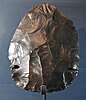
In archaeology, a bout-coupé is a type of handaxe that constituted part of the Neanderthal Mousterian industry of the Middle Palaeolithic. The handaxes are bifacially-worked and in the shape of a rounded triangle. They are only found in Britain in the Marine Isotope Stage 3 (MIS 3) interglacial between 59,000 and 41,000 years BP, and are therefore considered a unique diagnostic variant.[102][103]
Lynford Quarry is the location of a well-preserved in-situ Middle Palaeolithic open-air site near Mundford, Norfolk.[104]
Ebersdorf Stadial
edit
"Genetics suggests Neanderthal numbers dropped sharply around 50,000 years ago. This coincides with a sudden cold snap, hinting climate struck the first blow."[105]
"The first humans probably reached Australia around 50,000 years ago, which is the age of the oldest human skeletons and tools found."[106]
All "the Aborigines likely descend from a single population, which reached the Australian continent 50,000 years ago. Populations then spread rapidly – within 1,500 to 2,000 years – around the east and west coasts of Australia, meeting somewhere in South Australia. Over the following millennia, the population groups remained practically isolated."[106]
"Australia 50,000 years ago was part of the same landmass as New Guinea. So that the first Aborigines could have reached New Guinea by way of South East Asia and then have gone farther to Australia. There, they settled in groups over the whole continent."[106]
Many "groups of Aborigines used similar tools and shared a similar language. If humans did not move, how could tools and languages?"[107]
Marine Isotope Stage 4
edit
"During the Middle Stone Age of Southern Africa, technological and behavioral innovations led to significant changes in the lifeways of modern humans. The glacial episode of Marine Isotope Stage 4, about 57-71,000 years ago, resulted in cooler and drier climatic conditions and the expansion of grassland vegetation. Sea level dropped by as much as 80 meters below its current level. During this period the cultural phase known as the Howieson’s Poort appeared across much of Southern Africa, peaking at about 60-65,000 years ago, and then disappeared. The lithic industry of the Howieson’s Poort is exemplified by changes in technology, such as the use of the punch technique, an increase in the selection of fine-grained silcrete, and the predominance of retouched pieces including backed tools, segments, scrapers and points. Segments are the type fossil of the Howieson’s Poort and represent multi-purpose armatures that were hafted onto wooden spear shafts. The standardized design and refined style of segments convey information about the behavior of their makers and provide insight about group identity. Increasing use of ochre, the presence of engraved ostrich eggshells, and a bone tool industry are associated with these stone artifacts. Also evident is an intensified use of space. Taken together, these behaviors suggest that the Howieson’s Poort represents a clear marker of modern human culture."[108]
"Using stone tool residue analysis with supporting information from zooarchaeology, we provide evidence that at the Abri du Maras, Ardèche, France, Neanderthals [a skull is imaged on the left from Abri du Maras] were behaviorally flexible at the beginning of MIS 4. Here, Neanderthals exploited a wide range of resources including large mammals, fish, ducks, raptors, rabbits, mushrooms, plants, and wood. Twisted fibers on stone tools provide evidence of making string or cordage."[109]
Hypotheses
edit- Archaeology of Sclandinavia will eventually show it to have been occupied 40,000 b2k.
See also
edit- Abstract concept generator
- Anthropology
- Archeology (Portal:Archaeology)
- Classical planets
- Dominant group/Archaeology
- Dominant group/Culture
- Dominant group/Metagenome
- Genetics/Human DNA
- Genetics/Human teeth
- Genetics/Mammalogy
- Geochronology/Archaeology
- Geochronology/Cenozoic
- Geochronology/Classics
- Geochronology/Dates
- Geochronology/Dendrochronology
- Geochronology/Dye 3
- Geochronology/Geomagnetic Polarity Time Scale
- Geochronology/History
- Geochronology/Ice cores
- Geochronology/Ice cores/Black ice
- Geochronology/Ice cores/Brittle ice
- Geochronology/Ice cores/Clear ice
- Geochronology/Ice cores/Firns
- Geochronology/Ice cores/Sea ice
- Geochronology/Libyan history
- Geochronology/Medieval Warm Period
- Geochronology/Mesozoic
- Geochronology/Middle Ages
- Geochronology/Neoglaciations
- Geochronology/Optically stimulated luminescence
- Geochronology/Paleontology
- Geochronology/Paleozoic
- Geochronology/Palynology
- Geochronology/Radiocarbon dating
- Geochronology/Stratigraphy
- Geochronology/Tephra layers
- Geochronology/Uranium-thorium dating
- Hominins
- Paleanthropology
- Sciences
- Radiation astronomy/History
References
edit- ↑ Crazedandinfused (September 6, 2007). Topic:Archeology. http://en.wikiversity.org/w/index.php?title=Topic:Archeology&diff=156532&oldid=155948. Retrieved 2013-01-13.
- ↑ 2.0 2.1 Renfrew and Bahn (2004 [1991]:13)
- ↑ McPherron, S. P., Z. Alemseged, C. W. Marean, J. G. Wynn, D. Reed, D. Geraads, R. Bobe, and H. A. Bearat. 2010. Evidence for stone-tool-assisted consumption of animal tissues before 3.39 million years ago at Dikika, Ethiopia. Nature 466:857-860
- ↑ Tormod (13 July 2004). past. San Francisco, California: Wikimedia Foundation, Inc. http://en.wiktionary.org/wiki/past. Retrieved 2015-03-28.
- ↑ archaeology. San Francisco, California: Wikimedia Foundation, Inc. October 16, 2012. http://en.wiktionary.org/wiki/archaeology. Retrieved 2012-12-30.
- ↑ Paul A. Shackel (2000). Marcia-Anne Dobres and John E. Robb. ed. Craft to wage labor Agency and resistance in American historical archaeology, In: Agency in Archaeology. London: Routledge. http://www.bsos.umd.edu/ANTH/People/FacStaff/faculty/pshackel/Publications/Craft%20to%20Wage%20Labor,%20Agency%20and%20Resistance%20in%20American%20Historical%20Archaeology%202000.pdf. Retrieved 2011-12-06.
- ↑ Thomas A. Dowson (2000). "Why queer archaeology? An introduction". World Archaeology 32 (2): 161-5. doi:10.1080/00438240050131144. http://www.tandfonline.com/doi/abs/10.1080/00438240050131144. Retrieved 2012-01-03.
- ↑ Stephen L. Dyson (April 1985). "Two Paths to the past: A Comparative Study of the Last Fifty Years of American Antiquity and the American Journal of Archaeology". American Antiquity 50 (2): 452-63. http://www.jstor.org/stable/280503. Retrieved 2012-01-03.
- ↑ E. B. Banning (2002). Archaeological Survey. New York: Kluwer Academic Press.
- ↑ artifact. San Francisco, California: Wikimedia Foundation, Inc. 12 December 2014. http://en.wiktionary.org/wiki/artifact. Retrieved 2015-03-28.
- ↑ Six new sites inscribed on World Heritage List. UNESCO. http://whc.unesco.org/en/news/1160. Retrieved 23 June 2014.
- ↑ 12.0 12.1 The stone spheres of Costa Rica. BBC News. 29 March 2010. http://news.bbc.co.uk/1/hi/sci/tech/8593717.stm. Retrieved 2010-03-31.
- ↑ Brendan M. Lynch (22 Mar 2010). University of Kansas researcher investigates mysterious stone spheres in Costa Rica. http://www.eurekalert.org/pub_releases/2010-03/uok-uok032210.php. Retrieved 2010-03-24.
- ↑ National Academy of Sciences (1877). Samuel Kirkland Lothrup, In: Biographical memoirs, Volume 48. National Academies Press. p. 253. https://books.google.com/books?id=43U3AD_F9UMC&pg=PA253. Retrieved 2010-03-31.
- ↑ Tim McGuinness. Costa Rican Diquis Spheres: Sphere history. mysteryspheres.com. https://web.archive.org/web/20100329102018/http://www.mysteryspheres.com/history.htm. Retrieved 2010-03-31.
- ↑ Eleanor Lothrop (September 1955). Prehistoric Stone Balls—a Mystery, In: Picks from the Past. Natural History. http://naturalhistorymag.com/print/1353. Retrieved 2010-03-31.
- ↑ Gazetteer of Costa Rican Plant-Collecting Locales: Diquís (or Dikís) from the website of the Missouri Botanical Garden
- ↑ R. Lionel Fanthorpe; Patricia Fanthorpe; P. A. Fanthorpe (2006). Mysteries and Secrets of the Masons: The Story Behind the Masonic Order. Toronto, Canada: Dundurn Press. pp. 39–41. ISBN 978-1-55002-622-1. https://books.google.com/books?id=MXIIDlFKgcEC&pg=PA40&dq=dropa+stones.
- ↑ J. C. Vintner (2 September 2011). Ancient Earth Mysteries. AEM Publishing. p. 23. https://books.google.com/books?id=BzhZ_C3ccbwC&pg=PA23.
- ↑ Keith Fitzpatrick-Matthews (7 May 2007). The Dropa (or Dzopa) stones. Bad Archaeology. http://www.badarchaeology.com/out-of-place-artefacts/mysterious-objects/the-dropa-or-dzopa-stones/. Retrieved 12 February 2012.
- ↑ 21.00 21.01 21.02 21.03 21.04 21.05 21.06 21.07 21.08 21.09 Angelika Franz, translated from the German by Ami de Grazia (27 December 2010). Balkans: Archaeologists puzzle over 7,000y old copper-find - a tremendous fire destroyed a flourishing city. Der Spiegel. http://www.q-mag.org/balkans-archaeologists-puzzle-over-7000y-old-copper-find-a-tremendous-fire-destroyed-a-flourishing-city.html. Retrieved 2014-10-22.
- ↑ 22.0 22.1 Raiko Krauss, translated from the German by Ami de Grazia (27 December 2010). Balkans: Archaeologists puzzle over 7,000y old copper-find - a tremendous fire destroyed a flourishing city. Der Spiegel. http://www.q-mag.org/balkans-archaeologists-puzzle-over-7000y-old-copper-find-a-tremendous-fire-destroyed-a-flourishing-city.html. Retrieved 2014-10-22.
- ↑ Valentine Roux and Marie-Agnès Courty (2005). Identifying social entities at a macro-regional level: Chalcolithic ceramics of South Levant as a case study, In: Pottery Manufacturing Processes. University of Paris. pp. 201-14. http://www.mae.u-paris10.fr/prehistoire/IMG/pdf/RouxCourtyBAR2005.pdf. Retrieved 2014-05-13.
- ↑ Denis Byrne (1991). "Western hegemony in archaeological heritage management". History and Anthropology 5 (2): 269-76. doi:10.1080/02757206.1991.9960815. http://www.tandfonline.com/doi/abs/10.1080/02757206.1991.9960815. Retrieved 2012-02-16.
- ↑ 25.0 25.1 25.2 25.3 25.4 25.5 Marcello A. Canuto, Francisco Estrada-Belli, Thomas G. Garrison, Stephen D. Houston, Mary Jane Acuña, Milan Kováč, Damien Marken, Philippe Nondédéo, Luke Auld-Thomas, Cyril Castanet, David Chatelain, Carlos R. Chiriboga, Tomáš Drápela, Tibor Lieskovský, Alexandre Tokovinine, Antolín Velasquez, Juan C. Fernández-Díaz, Ramesh Shrestha (28 September 2018). "Ancient lowland Maya complexity as revealed by airborne laser scanning of northern Guatemala". Science 361 (6409): 1355. doi:10.1126/science.aau0137. http://science.sciencemag.org/content/361/6409/eaau0137. Retrieved 7 October 2018.
- ↑ Arlen Chase (September 27, 2018). Laser mapping shows the surprising complexity of the Maya civilization. Science News. https://www.sciencenews.org/article/laser-mapping-shows-surprising-complexity-maya-civilization?utm_source=email&utm_medium=email&utm_campaign=latest-newsletter-v2. Retrieved 7 October 2018.
- ↑ SemperBlotto (21 December 2014). prehistory. San Francisco, California: Wikimedia Foundation, Inc. http://en.wiktionary.org/wiki/prehistory. Retrieved 2015-03-28.
- ↑ 28.0 28.1 28.2 28.3 28.4 28.5 28.6 28.7 28.8 Candida Moss (4 August 2019). "Treasure Trove Discovered at Egypt's Atlantis, Where Cleopatra Was Crowned". Yahoo! News. Retrieved 5 August 2019.
- ↑ "TM Places". www.trismegistos.org. Retrieved 2019-05-26.
- ↑ "Heracleion Photos: Lost Egyptian City Revealed After 1,200 Years Under Sea". The Huffington Post. 29 April 2013.
- ↑ 31.0 31.1 31.2 Shenker, Jack (15 Aug 2016). "Lost cities #6: how Thonis-Heracleion resurfaced after 1,000 years under water". The Guardian. Retrieved 11 Feb 2018.
- ↑ "You won't believe what they found under the sea!". Geeks VIP. 12 July 2015. Archived from the original on 14 August 2018.
- ↑ AH Tunnacliffe, JG Hirst (1996). Optics. Kent, England. pp. 233–7. ISBN 0-900099-15-1.
- ↑ 34.0 34.1 34.2 Mariella Moon (17 February 2018). Ancient city's LiDAR scans reveal as many buildings as Manhattan. Yahoo News. https://www.yahoo.com/news/ancient-city-apos-lidar-scans-013300196.html?.tsrc=daily_mail&uh_test=2_13. Retrieved 18 February 2018.
- ↑ 35.0 35.1 Chris Fisher (17 February 2018). Ancient city's LiDAR scans reveal as many buildings as Manhattan. Yahoo News. https://www.yahoo.com/news/ancient-city-apos-lidar-scans-013300196.html?.tsrc=daily_mail&uh_test=2_13. Retrieved 18 February 2018.
- ↑ Carl O. Sauer (July 1941). "The personality of Mexico". Geographical Review 31 (3): 353-364. doi:10.2307/210171. http://www.jstor.org/stable/210171. Retrieved 2018-2-18.
- ↑ Winship. pp. 32–4, 37
- ↑ Flint, R. (Winter 2005). "What They Never Told You about the Coronado Expedition". Kiva 71 (2): 203–217.
- ↑ Joseph Needham (1986). Science and Civilization in China: Volume 3, Mathematics and the Sciences of the Heavens and the Earth. Taipei: Caves Books Ltd. pp. 208.
- ↑ 40.0 40.1 40.2 David Whitehouse (April 5, 2000). Did the Vikings make a telescope?. BBC News. http://news.bbc.co.uk/2/hi/science/nature/702478.stm. Retrieved 2012-10-03.
- ↑ 41.0 41.1 41.2 Michael McCormick, Paul Edward Dutton, and Paul A. Mayewski (October 2007). "Volcanoes and the Climate Forcing of Carolingian Europe, a.d. 750–950". Speculum A Journal of Medieval Studies 82 (4): 865-895. http://web-static-aws.seas.harvard.edu/climate/seminars/pdfs/mccormick_07.pdf. Retrieved 2017-10-22.
- ↑ 42.00 42.01 42.02 42.03 42.04 42.05 42.06 42.07 42.08 42.09 42.10 42.11 42.12 42.13 42.14 42.15 42.16 Gunnar Heinsohn (February 2017). "TENTH CENTURY COLLAPSE". Q-Magazine: 1-26. http://www.q-mag.org/_iserv/dlfiles/dl.php?ddl=q-mag-gunnar-10thcentury.pdf. Retrieved 2017-04-01.
- ↑ Lindqvist, Herman. Historien om Sverige. Islossning till kungarike. 1996. See page 165.
- ↑ J. Campbell (2003). C. Cubitt Hg.. ed. Anglo-Saxon Courts, In: Court Culture in the Early Middle Ages: The Proceedings of the First Alcuin Conference. Belgium: Brepols: Turnhout. pp. 155-169. http://www.q-mag.org/arthur-of-camelot-and-aththe-of-camulodunum.html. Retrieved 2017-06-21.
- ↑ English Heritage (2017). Story of England. Dark Ages: c 410-1066. http://www.english-heritage.org.uk/learn/story-of-england/dark-ages/architecture/. Retrieved 2017-06-21.
- ↑ M.E. Jones (1998). The End of Roman Britain. Ithaca, NY: Cornell University Press. pp. 23. http://www.q-mag.org/arthur-of-camelot-and-aththe-of-camulodunum.html. Retrieved 2017-06-21.
- ↑ P.J. Fowler (2002). Farming in the First Millennium A.D.: British Agriculture Between Julius Caesar and William the Conqueror. Cambridge, UK: Cambridge University Press. pp. 28. http://www.q-mag.org/arthur-of-camelot-and-aththe-of-camulodunum.html. Retrieved 2017-06-21.
- ↑ 48.00 48.01 48.02 48.03 48.04 48.05 48.06 48.07 48.08 48.09 48.10 48.11 48.12 48.13 48.14 48.15 48.16 48.17 Gunnar Heinsohn (15 June 2017). ARTHUR OF CAMELOT AND ATHTHE-DOMAROS OF CAMULODUNUM: A STRATIGRAPHY-BASED EQUATION PROVIDING A NEW CHRONOLOGY FOR 1st MIILLENNIUM ENGLAND. Quantavolution Magazine. http://www.q-mag.org/arthur-of-camelot-and-aththe-of-camulodunum.html. Retrieved 2017-06-21.
- ↑ K. Wiles (5 May 2016). "Back to the Dark Ages". History Today. http://www.historytoday.com/kate-wiles/back-dark-ages. Retrieved 2017-06-21.
- ↑ Gustafson, Alrik, Svenska litteraturens historia, 2 volums (Stockholm, 1963). First published as A History of Swedish Literature (American-Scandinavian Foundation, 1961). Chapter 1.
- ↑ Forntid och medeltid, Lönnroth, in Lönnroth, Göransson, Delblanc, Den svenska litteraturen, vol 1.
- ↑ New interpretation of the Rök runestone inscription changes view of Viking Age (University of Gothenburg)
- ↑ Holmberg, Per (2015) Svaren på Rökstenens gåtor: En socialsemiotisk analys av meningsskapande och rumslighet ("The answers to Rök stone riddles: A social analysis of the meaning and spatiality") Futhark: International Journal of Runic Studies, Vol. 6. pp. 65-106. (in Swedish)
- ↑ 54.0 54.1 Per Holmberg, Bo Gräslund, Olof Sundqvist and Henrik Williams (15 January 2020). "The Rök Runestone and the End of the World". Futhark: International Journal of Runic Studies 9-10: 7-38. doi:10.33063/diva-401040. https://doi.org/10.33063/diva-401040. Retrieved 19 January 2020.
- ↑ 55.0 55.1 55.2 55.3 British Library (June 2015). The Dunhuang Star Atlas. British Library: International Dunhuang Project (IDP). http://idp.bl.uk/4DCGI/education/astronomy/atlas.html. Retrieved 2015-12-27.
- ↑ T. Millat (1982). Essex Archaeology and History. Mersea, UK: Mersea Museum. http://www.merseamuseum.org.uk/mmresdetails.php?tot=1&cat=&col=MM&typ=ID&rt=Article&syn=all&ord=dtadd&hit=0&pid=EAH_014_077. Retrieved 2017-06-21.
- ↑ Gunnar Heinsohn (15 March 2017). "Felix Romuliana". Q Magazine. http://www.q-mag.org/. Retrieved 2017-05-13.
- ↑ Bill Casselman. One of the Oldest Extant Diagrams from Euclid. University of British Columbia. http://www.math.ubc.ca/~cass/Euclid/papyrus/papyrus.html. Retrieved 26 September 2008.
- ↑ D.C. Briscoe (2016). "Two Important Stamp Motifs in Roman Britain and Thereafter, In: Romano-British Pottery in the Fifth Century". Internet Archaeology (41). doi:https://doi.org/10.11141/ia.41.2.
- ↑ L. Bekić (2016). "Nalazi 8. i 9. stoljeća sa Šarnjaka kod Šemovca / Finds from the 8th and 9th centuries at Šarnjak near Šemovec". Vjesnik Arheološkog muzeja u Zagrebu (VAMZ) XLIX: 219-248.
- ↑ Jo Marchant (30 November 2006). "In search of lost time". Nature 444 (7119): 534-538. doi:10.1038/444534a. https://www.nature.com/nature/journal/v444/n7119/full/444534a.html. Retrieved 2017-11-05.
- ↑ K. Shillington, History of Africa (3rd ed. 2005), 61–68.
- ↑ Duncan E. Miller and N.J. Van Der Merwe, 'Early Metal Working in Sub Saharan Africa' Journal of African History 35 (1994) 1-36
- ↑ Minze Stuiver and N.J. Van Der Merwe, 'Radiocarbon Chronology of the Iron Age in Sub-Saharan Africa' Current Anthropology 1968. Tylecote 1975
- ↑ 65.0 65.1 65.2 65.3 Giacomo Capuzzo (2014). SPACE-TEMPORAL ANALYSIS OF RADIOCARBON EVIDENCE AND ASSOCIATED ARCHAEOLOGICAL RECORD: FROM DANUBE TO EBRO RIVERS AND FROM BRONZE TO IRON AGES. BARCELONA, Spain: UNIVERSITAT AUTÒNOMA DE BARCELONA. pp. 416. https://ddd.uab.cat/pub/tesis/2014/hdl_10803_283401/gc1de1.pdf. Retrieved 2017-10-11.
- ↑ Holl, Augustin F. C. (June 2020). "The Origins of African Metallurgies". Oxford Research Encyclopedias 22 (4): 415–438. doi:10.1093/acrefore/9780190854584.013.63.
- ↑ Eze–Uzomaka, Pamela (2013). J. Humphris & T. Rehren. ed. Iron and its influence on the prehistoric site of Lejja, In: The world of iron. London: Archetype. pp. 3-9. https://www.academia.edu/4103707/Iron_and_its_influence_on_the_prehistoric_site_of_Lejja.
- ↑ Eggert, Manfred (2014). "Early iron in West and Central Africa". In Breunig, P. Nok: African Sculpture in Archaeological Context. Frankfurt, Germany: Africa Magna Verlag Press. pp. 1–2.
- ↑ Holl, Augustin F. C. (June 2020). "The Origins of African Metallurgies". Oxford Research Encyclopedias 22 (4): 415–438. doi:10.1093/acrefore/9780190854584.013.63. ISBN 9780190854584.
- ↑ 70.0 70.1 70.2 Thilo Rehrena; Tamás Belgya; Albert Jambon; György Káli; Zsolt Kasztovszky; Zoltán Kis; Imre Kovács; Boglárka Maróti et al. (December 2013). "5,000 years old Egyptian iron beads made from hammered meteoritic iron". Journal of Archaeological Science 40 (12): 4785–92. doi:10.1016/j.jas.2013.06.002. http://www.sciencedirect.com/science/article/pii/S0305440313002057. Retrieved 2016-10-23.
- ↑ Archaeomineralogy, p. 164, George Robert Rapp, Springer, 2002
- ↑ Understanding materials science, p. 125, Rolf E. Hummel, Springer, 2004
- ↑ "Lost city of Heracleion gives up its secrets". The Telegraph. Retrieved 2013-06-06.
- ↑ Sooke, Alastair. "Sunken Cities: the man who found Atlantis". The Telegraph. Retrieved 22 September 2016.
- ↑ 75.0 75.1 A. Speranza; J. van der Plicht; B. van Geel (November 2000). "Improving the time control of the Subboreal/Subatlantic transition in a Czech peat sequence by 14C wiggle-matching". Quaternary Science Reviews 19 (16): 1589-1604. doi:10.1016/S0277-3791(99)00108-0. http://www.researchgate.net/publication/30494985_Improving_the_time_control_of_the_SubborealSubatlantic_transition_in_a_Czech_peat_sequence_by_14C_wiggle-matching/file/60b7d51c350cf2efa0.pdf. Retrieved 2014-11-04.
- ↑ S Bourke; U Zoppi; J Meadows; Q Hua; S Gibbins (January 2009). "The beginning of the Early Bronze Age in the north Jordan Valley: new 14C determinations from Pella in Jordan". Radiocarbon 51 (3): 905-913. doi:10.2458/azu_js_rc.51.3549. https://www.researchgate.net/profile/Quan_Hua2/publication/260038389_The_Beginning_of_the_Early_Bronze_Age_in_the_North_Jordan_Valley_New_14C_determinations_from_Pella_in_Jordan/links/00b49537d32bf17b4a000000.pdf. Retrieved 2016-10-23.
- ↑ David Whitehouse (July 1, 1999). World's oldest telescope?. http://news.bbc.co.uk/1/hi/sci/tech/380186.stm. Retrieved May 10, 2008.
- ↑ Dimitris Plantzos (July 1997). "Crystals and Lenses in the Graeco-Roman World". American Journal of Archaeology 101 (3): 451-64. http://www.hist-arch.uoi.gr/prosopiko/plantzos/Crystals.pdf. Retrieved 2011-10-17.
- ↑ 79.0 79.1 79.2 79.3 Maria Eugenia Aubet (2008). Political and Economic Implications of the New Phoenician Chronologies. Universidad Pompeu Fabra. pp. 179. http://www.upf.edu/larq/_pdf/AubtCrono.pdf. Retrieved 24 February 2013.
- ↑ Sabatino Moscati (12 January 2001). Sabatino Moscati. ed. Colonization of the Mediterranean, In: The Phoenicians. I.B.Tauris. p. 48. ISBN 978-1-85043-533-4. https://books.google.com/books?id=1EEtmT9Tbj4C. Retrieved 12 February 2013.
- ↑ Christopher T. Fisher; Helen P. Pollard; Isabel Israde-Alcántara; Victor H. Garduño-Monroy; Subir K. Banerjee (April 2003). "A reexamination of human-induced environmental change within the Lake Pátzcuaro Basin, Michoacán, Mexico". Proceedings of the National Academy of Sciences USA 100 (8): 4957-4962. doi:10.1073/pnas.0630493100. http://www.pnas.org/content/100/8/4957.long. Retrieved 2018-2-25.
- ↑ 82.0 82.1 Christopher Bronk Ramsey; Michael W. Dee; Joanne M. Rowland; Thomas F. G. Higham; Stephen A. Harris; Fiona Brock; Anita Quiles; Eva M. Wild et al. (18 June 2010). "Radiocarbon-Based Chronology for Dynastic Egypt". Science 328 (5985): 1554-1557. doi:10.1126/science.1189395. http://science.sciencemag.org/content/328/5985/1554. Retrieved 2017-10-11.
- ↑ 83.0 83.1 Dalya Alberge (2 August 2015). "Ancient Egyptian underwater treasures to be exhibited for the first time". The Guardian.
- ↑ 84.0 84.1 84.2 Naukratis: a city and trading port in Egypt, British Museum
- ↑ Herodotus, Histories, 2.113-115
- ↑ Hendrik Bruins; Johannes van der Plicht (1995). "Tell-es-Sultan (Jericho): Radiocarbon results of short-lived cereal and multiyear charcoal samples from the end of the Middle Bronze Age". Radiocarbon 37 (2): 213-220. https://journals.uair.arizona.edu/index.php/radiocarbon/article/viewFile/1666/1670. Retrieved 2017-10-11.
- ↑ 87.0 87.1 87.2 J.N. Lanting (2015). "DATES FOR ORIGIN AND DIFFUSION OF THE EUROPEAN LOGBOAT". Palaeohistoria 57: 627-650. http://ugp.rug.nl/Palaeohistoria/article/download/25107/22563. Retrieved 2017-10-13.
- ↑ B.S. Ottaway (2001). "Innovation, production and specialization in early prehistoric copper metallurgy". European Journal of Archaeology 4 (1): 87-112. doi:10.1179/eja.2001.4.1.87. http://www.tandfonline.com/doi/abs/10.1179/eja.2001.4.1.87. Retrieved 2016-10-23.
- ↑ 89.0 89.1 E.B. Karabanov; A.A. Prokopenko; D.F. Williams; G.K. Khursevich (March 2000). "A new record of Holocene climate change from the bottom sediments of Lake Baikal". Palaeogeography, Palaeoclimatology, Palaeoecology 156 (3-4): 211–24. doi:10.1016/S0031-182(99)00141-8. http://www.sciencedirect.com/science/article/pii/S0031018299001418. Retrieved 2014-11-04.
- ↑ 90.0 90.1 90.2 Kasha Patel (19 September 2019). "Drought Reveals Lost "Spanish Stonehenge"". Washington, DC USA: NASA. Retrieved 19 September 2019.
- ↑ 91.0 91.1 John Darnell (22 June 2017). 5,000-Year-Old 'Billboard' of Hieroglyphs Contains a Cosmic Message. Live Science. https://www.livescience.com/59588-billboard-of-hieroglyphs-contains-cosmic-message.html. Retrieved 2017-06-25.
- ↑ Willi Dansgaard (2005). The Department of Geophysics of The Niels Bohr Institute for Astronomy Physics and Geophysics at The University of Copenhagen Denmark. ed. Frozen Annals Greenland Ice Cap Research. Copenhagen, Denmark: Niels Bohr Institute. pp. 123. ISBN 87-990078-0-0. http://www.iceandclimate.nbi.ku.dk/publications/FrozenAnnals.pdf/. Retrieved 2014-10-05.
- ↑ S.O. Rasmussen, B.M. Vinther, H.B. Clausen, and K.K. Andersen. Greenland Ice Core Chronology 2005 (GICC05) Early Holocene section. IGBP PAGES/World Data Center for Paleoclimatology Data Contribution Series # 2006-119. NOAA/NCDC Paleoclimatology Program, Boulder CO, USA.
- ↑ Botteville (19 February 2006). Atlantic (period). San Francisco, California: Wikimedia Foundation, Inc. https://en.wikipedia.org/wiki/Atlantic_(period). Retrieved 15 July 2018.
- ↑ J. W. Franks; W. Pennington (April 1961). "The Late-Glacial and Post-Glacial Deposits of the Esthwaite Basin, North Lancashire". New Phytologist 60 (1): 27-42. http://onlinelibrary.wiley.com/store/10.1111/j.1469-8137.1961.tb06237.x/asset/j.1469-8137.1961.tb06237.x.pdf;jsessionid=EB6966DF0A2FBCC3534CCD6A6413808D.f02t01?v=1&t=i23es9k1&s=e619673cf5bc8be51450a303a914df03f8cba94d. Retrieved 2014-11-04.
- ↑ Miljana Radivojevic; Thilo Rehren (23 September 2010). Serbian site may have hosted first copper makers. London, England: UCL Institute of Archaeology. http://www.ucl.ac.uk/archaeology/calendar/articles/20100924. Retrieved 2015-01-18.
- ↑ Linder, F. (1997). Social differentiering i mesolitiska jägar-samlarsamhällen. Uppsala.: Institutionen för arkeologi och antik historia, Uppsala universitet.
- ↑ Conneller, Chantal; Bayliss, Alex; Milner, Nicky; Taylor, Barry (2016). "The Resettlement of the British Landscape: Towards a chronology of Early Mesolithic lithic assemblage types". Internet Archaeology 42. doi:10.11141/ia.42.12.
- ↑ Christian, David (2014). Big History: Between Nothing and Everything. New York: McGraw Hill Education. p. 93.
- ↑ Toth, Nicholas; Schick, Kathy (2007). "Handbook of Paleoanthropology". Handbook of Paleoanthropology: 1943–1963. doi:10.1007/978-3-540-33761-4_64. http://www.springerlink.com/content/u68378621542472j. In Henke, H.C. Winfried; Hardt, Thorolf; Tatersall, Ian. Handbook of Paleoanthropology. Volume 3. Berlin; Heidelberg; New York: Springer-Verlag. p. 1944. (PRINT: ISBN 978-3-540-32474-4 ONLINE: ISBN 978-3-540-33761-4)
- ↑ Gamble, Clive (1990), El poblamiento Paleolítico de Europa, Barcelona: Editorial Crítica. ISBN 84-7423-445-X.
- ↑ Pettitt, Paul; White, Mark (2012). The British Palaeolithic: Human Societies at the Edge of the Pleistocene World. Abingdon, UK: Routledge. p. 349. ISBN 978-0-415-67455-3.
- ↑ White, Mark J; Jacobi, Roger M (May 2002). "Two Sides to Every Story: Bout Coupé Handaxes Revisited". Oxford Journal of Archaeology (Wiley Online Library) 21 (2): 109–133. doi:10.1111/1468-0092.00152. http://onlinelibrary.wiley.com/doi/10.1111/1468-0092.00152/abstract.
- ↑ Lynford Quarry, Mundford, Norfolk. English Heritage. 30 May 2003. http://webarchive.nationalarchives.gov.uk/20060214231123/http://www.english-heritage.org.uk/server/show/conWebDoc.3892. Retrieved 17 August 2014.
- ↑ Catherine Brahic (08 August 2014). "Human exodus may have reached China 100,000 years ago". New Scientist. http://www.newscientist.com/article/mg22329813.000-human-exodus-may-have-reached-china-100000-years-ago.html#.U-_PEShOSlI. Retrieved 2014-08-16.
- ↑ 106.0 106.1 106.2 Alan Cooper. How the Aborigenes came to Australia. Q-Magazine. http://www.q-mag.org/how-the-aborigenes-came-to-australia.html. Retrieved 2017-05-29.
- ↑ Peter Bellwood (9 March 2017). How the Aborigenes came to Australia. Q-Magazine. http://www.q-mag.org/how-the-aborigenes-came-to-australia.html. Retrieved 2017-05-29.
- ↑ ROCEEH (1 July 2010). File:Motm 2010 07 Howiesons Poort.pdf. Wikimedia. https://commons.wikimedia.org/wiki/File:Motm_2010_07_Howiesons_Poort.pdf. Retrieved 11 July 2018.
- ↑ Bruce L. Hardy; Marie-Hélène Moncel; Camille Daujeard; Paul Fernandes; Philippe Béarez; Emmanuel Desclaux; Maria Gem; Chacon Navarro et al. (15 December 2013). "Impossible Neanderthals? Making string, throwing projectiles and catching small game during Marine Isotope Stage 4 (Abri du Maras, France)". Quaternary Science Reviews 82 (12): 23-40. doi:10.1016/j.quascirev.2013.09.028. https://www.sciencedirect.com/science/article/pii/S0277379113003788. Retrieved 12 July 2018.
External links
edit{{Geology resources}}{{Humanities resources}}
Learn more about Archaeology |
Learn more about Archeology |