File:Storfjorden autumn, 2009 09.jpg

Size of this preview: 800 × 255 pixels. Other resolutions: 320 × 102 pixels | 640 × 204 pixels | 1,024 × 326 pixels | 1,280 × 408 pixels | 5,600 × 1,784 pixels.
Original file (5,600 × 1,784 pixels, file size: 9.71 MB, MIME type: image/jpeg)
| This is a file from the Wikimedia Commons. The description on its description page there is shown below.
Commons is a freely licensed media file repository. You can help. |
|
This image has been assessed using the Quality image guidelines and is considered a Quality image.
|
| Description |
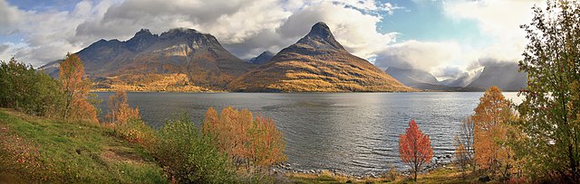
English: A view to the autumnal mountains such as Horsnesfjellet and Hatten on the other side of Storfjorden, Troms, Norway in 2010 September.
Suomi: Näkymä syysruskan värjäämille vuorille (kuten Horsnesinvaaralle ja Hatulle) Storfjorden-vuonon (Osa Yykeänvuonoa) vastarannalta, Omasvuonon kunnassa, Tromssan läänissä, Norjassa syyskuussa 2010.
Français : Vue automnale (prise en semptembre 2010) sur les montagnes du Horsnesfjellet et de Hatten, de l'autre côté du Storfjord, dans le comté de Troms, en Norvège. |
| Date | |
| Source | Own work |
| Author | Ximonic, Simo Räsänen |
| Camera location | | View this and other nearby images on: OpenStreetMap |
|---|

|
Permission is granted to copy, distribute and/or modify this document under the terms of the GNU Free Documentation License, Version 1.2 or any later version published by the Free Software Foundation; with no Invariant Sections, no Front-Cover Texts, and no Back-Cover Texts. A copy of the license is included in the section entitled GNU Free Documentation License. |
| Annotations | This image is annotated: View the annotations at Commons |
File history
Click on a date/time to view the file as it appeared at that time.
| Date/Time | Thumbnail | Dimensions | User | Comment | |
|---|---|---|---|---|---|
| current | 17:08, 1 January 2011 | 5,600 × 1,784 (9.71 MB) | Ximonic | Overall desaturation | |
| 13:35, 26 December 2010 | 5,600 × 1,784 (9.79 MB) | Ximonic | Fixed the unnecessary color disappear of some blue areas | ||
| 13:27, 26 December 2010 | 5,600 × 1,784 (9.77 MB) | Ximonic | Some color ranges desaturated, chromatic aberration removal | ||
| 13:58, 13 November 2010 | 5,600 × 1,784 (10.08 MB) | Ximonic |
File usage
The following page uses this file:
Global file usage
The following other wikis use this file:
- Usage on da.wikipedia.org
- Usage on de.wikipedia.org
- Usage on en.wikipedia.org
- Usage on nl.wikipedia.org
- Usage on no.wikipedia.org
- Usage on or.wikipedia.org
- Usage on ru.wikipedia.org
- Usage on se.wikipedia.org
- Usage on vi.wikipedia.org