File:Sossusvlei.jpg
Size of this preview: 800 × 533 pixels. Other resolutions: 320 × 213 pixels | 640 × 427 pixels | 1,024 × 683 pixels | 1,280 × 853 pixels | 2,560 × 1,707 pixels | 3,879 × 2,586 pixels.
Original file (3,879 × 2,586 pixels, file size: 2.63 MB, MIME type: image/jpeg)
| This is a file from the Wikimedia Commons. The description on its description page there is shown below.
Commons is a freely licensed media file repository. You can help. |
Summary
| Camera location | | View this and other nearby images on: OpenStreetMap |
|---|
| Description |
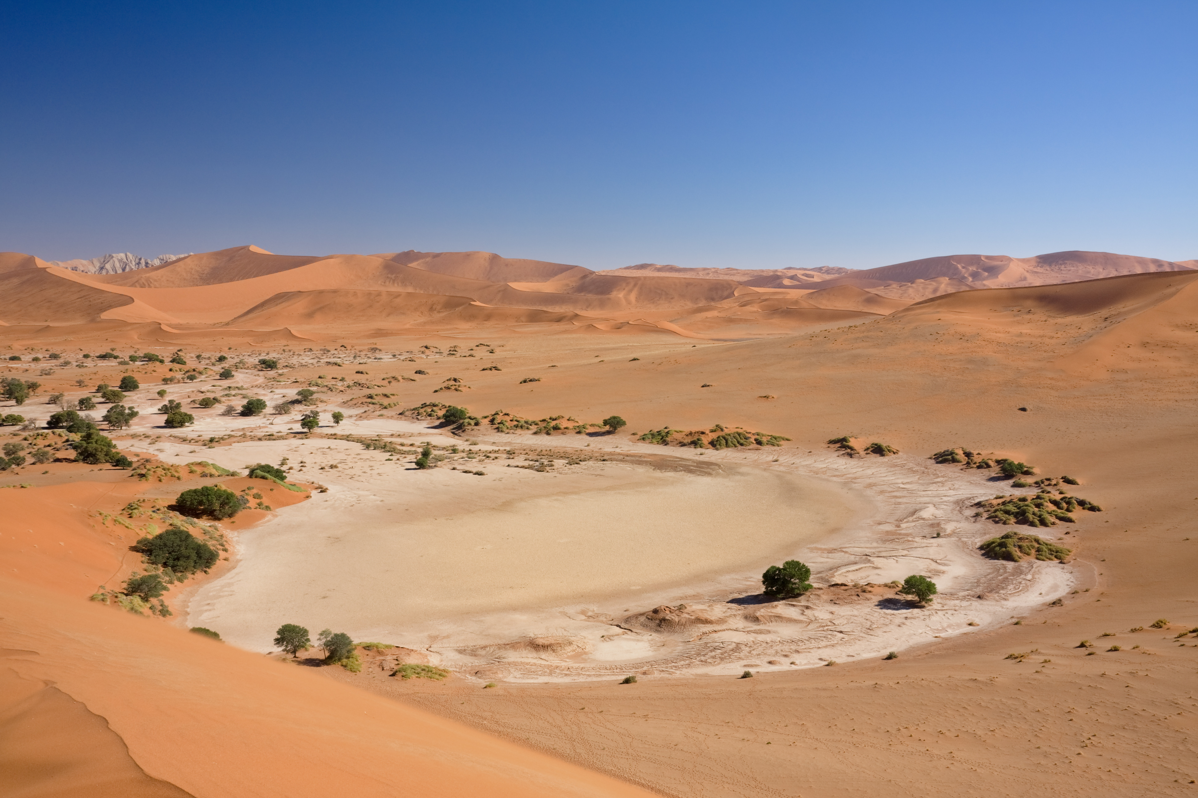
Afrikaans: Die kleipan by Sossusvlei, wat sowat een keer per dekade deur die Tsauchab-rivier gevul word. Dit is geleë in die sentrale Namib-Naukluft, westelike Hardap-streek, Namibië
English: The clay pan at Sossusvlei, which is filled about once in a decade by the Tsauchab river. It is situated in the central Namib Naukluft, western Hardap Region, Namibia
|
|||
| Date | ||||
| Source | Own work | |||
| Author | Ikiwaner | |||
| Permission (Reusing this file) |
|
|||
| Other versions |
Autumn 2006; Winter 2006   |

|

File history
Click on a date/time to view the file as it appeared at that time.
| Date/Time | Thumbnail | Dimensions | User | Comment | |
|---|---|---|---|---|---|
| current | 19:25, 19 October 2009 | | 3,879 × 2,586 (2.63 MB) | Ikiwaner | {{Information |Description={{de|Das Soussusvlei in Namibia}} |Source={{Own}} |Date=siehe Bild-Metadaten |Author=Ikiwaner }} {{GFDL-1.2}} Category:Sossusvlei |
File usage
The following 2 pages use this file:
Global file usage
The following other wikis use this file:
- Usage on af.wikipedia.org
- Usage on ar.wikipedia.org
- Usage on br.wikipedia.org
- Usage on ckb.wikipedia.org
- Usage on de.wikipedia.org
- Usage on en.wikipedia.org
- Wikipedia:WikiProject Protected areas
- Namib
- User talk:Ikiwaner
- Wikipedia:Featured pictures/Places/Landscapes
- Sossusvlei
- List of biogeographic provinces
- Talk:Sossusvlei
- Dung midden
- User:Daniel Mietchen/Science communication gallery
- Wikipedia:Featured pictures thumbs/21
- Wikipedia:Featured picture candidates/December-2009
- Wikipedia:Featured picture candidates/File:Sossusvlei.jpg
- Wikipedia:Wikipedia Signpost/2009-12-28/Features and admins
- User talk:JJ Harrison/Archive3
- Wikipedia:Picture of the day/July 2011
- Template:POTD/2011-07-16
- Wikipedia:Main Page history/2011 July 16
- Wikipedia:Wikipedia Signpost/2009-12-28/SPV
- Wikipedia:Wikipedia Signpost/Single/2009-12-28
- Usage on en.wikibooks.org
- Usage on fi.wikipedia.org
- Usage on fr.wikipedia.org
- Usage on gn.wikipedia.org
- Usage on he.wikipedia.org
- Usage on hr.wikipedia.org
- Usage on hu.wikipedia.org
- Usage on id.wikipedia.org
- Usage on lt.wiktionary.org
- Usage on mt.wikipedia.org
- Usage on nl.wikipedia.org
- Usage on pl.wikipedia.org
- Usage on pt.wikipedia.org
- Usage on ru.wiktionary.org
- Usage on sh.wikipedia.org
- Usage on sl.wikipedia.org
- Usage on sw.wikipedia.org
View more global usage of this file.