File:Ready to Explore (16393446760).jpg
Original file (2,712 × 3,756 pixels, file size: 2.85 MB, MIME type: image/jpeg)
| This is a file from the Wikimedia Commons. The description on its description page there is shown below.
Commons is a freely licensed media file repository. You can help. |
.jpg)
Summary
| Description |
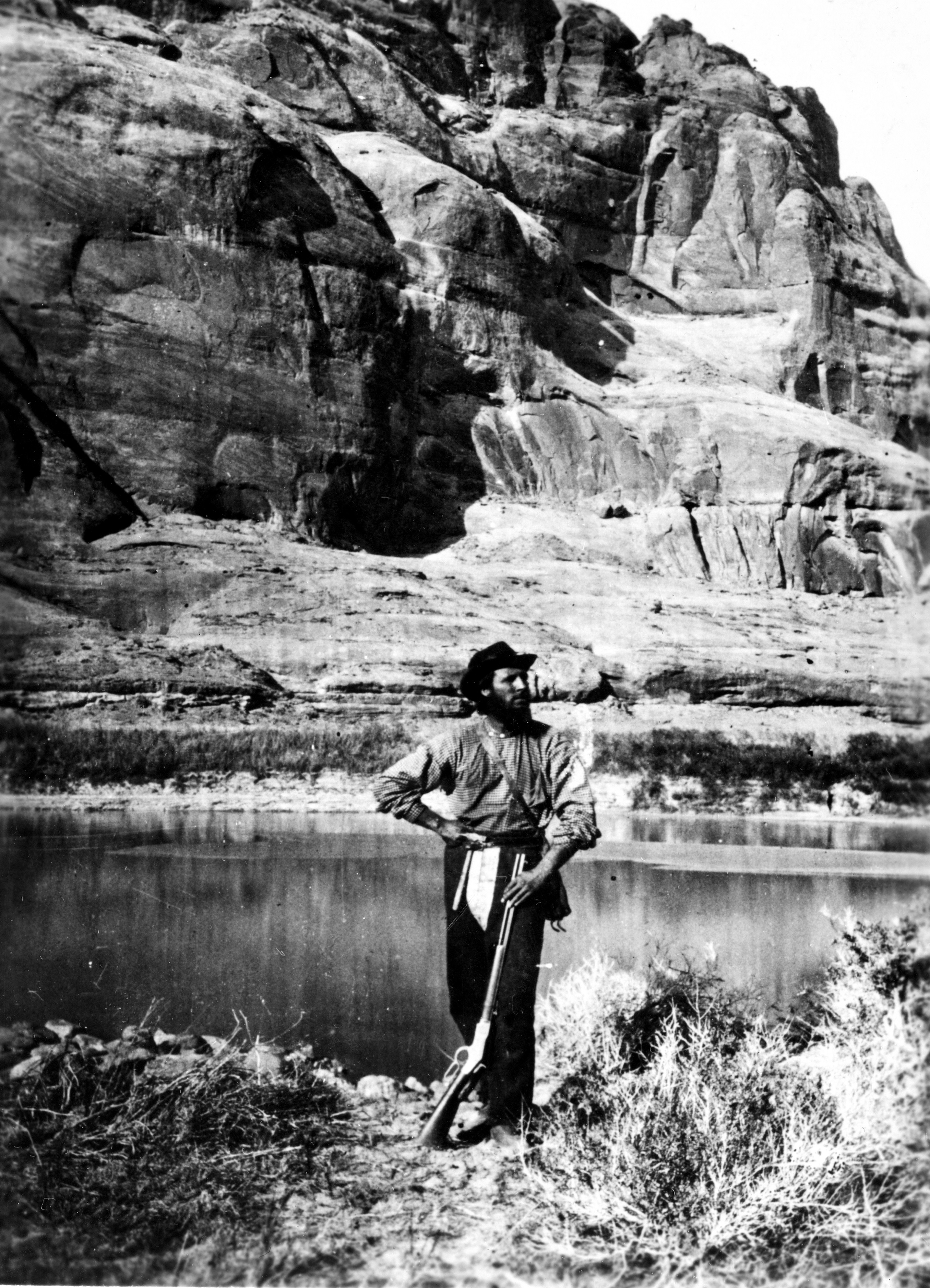
Our #TBT photo shows John F. Steward, a member of the Powell Survey, in Glen Canyon, Colorado River. He is shown with the typical field equipment of those early Surveys: gun, pick, map case, and a canteen. This photo was taken in Kane County, Utah in 1872. Major John Wesley Powell led several expeditions along the Colorado River beginning in the summer of 1867 through 1879. As Professor of Geology and Natural History in the State Normal University of Illinois, he made the first trip in 1867 with the objective to increase the geological and zoological collections. Later expeditions were made under Congressional appropriations and Survey members included artists, geologists and topographers. Topographic base maps, compiled from the Powell Survey, were published as 1-degree sheets and covered 67,000 square miles. A truly fascinating read on the USGS mapping program from its inception in the various Surveys of the 19th century to the mid-1950's can be found in the History of the Topographic Branch (Division): pubs.usgs.gov/circ/1341/ |
| Date | |
| Source | Ready to Explore |
| Author | U.S. Geological Survey from Reston, VA, USA |
Licensing
| This file is made available under the Creative Commons CC0 1.0 Universal Public Domain Dedication. | |
| The person who associated a work with this deed has dedicated the work to the public domain by waiving all of their rights to the work worldwide under copyright law, including all related and neighboring rights, to the extent allowed by law. You can copy, modify, distribute and perform the work, even for commercial purposes, all without asking permission.
|
| This image was originally posted to Flickr by U.S. Geological Survey at https://flickr.com/photos/27784370@N05/16393446760 (archive). It was reviewed on 19 January 2018 by FlickreviewR 2 and was confirmed to be licensed under the terms of the cc-zero. |
This image is in the public domain in the United States because it only contains materials that originally came from the United States Geological Survey, an agency of the United States Department of the Interior. For more information, see the official USGS copyright policy.
|
File history
Click on a date/time to view the file as it appeared at that time.
| Date/Time | Thumbnail | Dimensions | User | Comment | |
|---|---|---|---|---|---|
| current | 21:01, 19 January 2018 | | 2,712 × 3,756 (2.85 MB) | Artix Kreiger 2 | Transferred from Flickr via Flickr2Commons |
File usage
The following page uses this file:
.jpg)