Category:Oceanography images
Media in category "Oceanography images"
The following 46 files are in this category, out of 46 total.
-
Antarctic continental shelves.jpg 536 × 526; 104 KB
-
Arctic Sea Ice Pause.jpg 656 × 501; 167 KB
-
Arctic Surface Temperatures 1920-2016.jpg 893 × 458; 210 KB
-
Azores current.png 443 × 292; 85 KB
-
Azores plateau and corresponding structures.png 609 × 425; 561 KB
-
Bathymetry and selected features of the seas around Scotland.png 1,457 × 1,082; 1.81 MB
-
Bathymetry of the Mauritanian and Senegambian continental shelf.png 341 × 1,127; 230 KB
-
Bathymetry of the NES LME and adjacent offshore waters.png 480 × 479; 309 KB
-
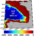
Bay of Biscay bathymetry.png 320 × 337; 102 KB
-
Calvert topomap.gif 534 × 438; 198 KB
-
Central California continental shelves.jpeg 463 × 600; 46 KB
-
Composite-lost-continent-dd1.jpg 750 × 500; 72 KB
-
Deruelle-atlantide006.jpg 653 × 734; 138 KB
-
Digital Elevation Model (250 m grid) of the seabed of the Aegean Sea.png 850 × 988; 1.49 MB
-
Elevation map shows principal tectonic domains.jpg 430 × 387; 90 KB
-
Gravimetric map Angola.jpg 520 × 350; 48 KB
-
Gulf Stream.jpg 626 × 466; 198 KB
-
Gulfstream surface1.jpg 750 × 524; 157 KB
-
Gulfstream surface2.jpg 480 × 320; 58 KB
-
Iberian coast bathymetry, & area map.JPG 1,154 × 623; 126 KB
-
Iberian margin AGADIR.jpg 600 × 607; 133 KB
-
Location of major seamounts off the New England shelf.jpg 572 × 388; 28 KB
-
M2I22 Shoreline.png 800 × 508; 577 KB
-
Map-labrador-sea.jpg 750 × 563; 175 KB
-
Mediterranean Bathymetric map.png 1,069 × 644; 1.3 MB
-
More Cameroon shelves.png 320 × 426; 234 KB
-
Namibian continental shelf.jpg 3,012 × 2,411; 893 KB
-
Nigeria-Bonga map.jpg 1,280 × 880; 303 KB
-
North Atlantic Ridge 45N045W.jpg 1,350 × 1,350; 776 KB
-
North Sea continental shelf.jpg 600 × 752; 148 KB
-
Northwest edge of the continental shelves.png 728 × 680; 394 KB
-
NW African continental margin.png 738 × 954; 868 KB
-
RTEmagicC mauritia Google-earth txdam35307 4d40ce.jpg 450 × 300; 18 KB
-
Sea surface temperature data.gif 1,000 × 517; 1.09 MB
-
South African continental shelves.jpg 550 × 416; 57 KB
-
South Atlantic sea floor.jpg 1,280 × 958; 333 KB
-
Southwest Iberian Margin.png 1,008 × 708; 1.2 MB
-
Sri-Lanka-Omaru-Whale-11-1.jpg 1,000 × 1,000; 254 KB
-
Sri-Lanka-Omaru-Whale-53.jpg 1,000 × 665; 89 KB
-
Submissioner Grønland hjemmeside.png 620 × 867; 781 KB
-
The Real Map of Ireland.jpg 1,200 × 913; 199 KB
-
Topographic map Azores archipelago.jpg 650 × 460; 106 KB
-
Topographic map of the NW African continental margin.jpg 926 × 821; 179 KB
-
Topography & Bathymetry West Iberia.jpg 1,239 × 811; 197 KB
-
Upper 2000 m OHC from 1955 through 2019.png 692 × 353; 114 KB