File:PIA09076.jpg

Original file (3,253 × 2,415 pixels, file size: 1.73 MB, MIME type: image/jpeg)
| This is a file from the Wikimedia Commons. The description on its description page there is shown below.
Commons is a freely licensed media file repository. You can help. |
Summary
| Description |
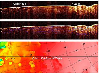
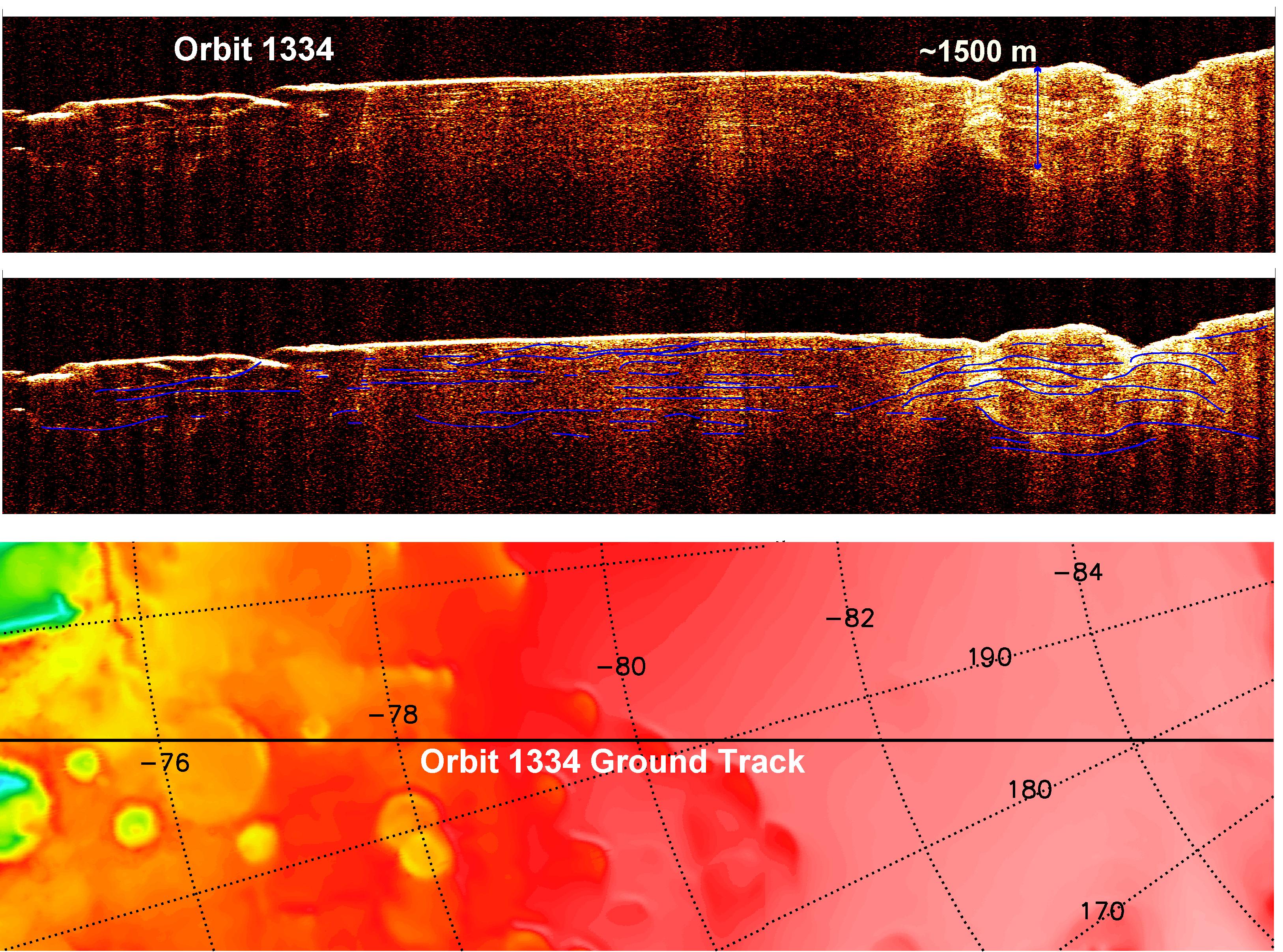
English: A radargram from the Shallow Subsurface Radar instrument (SHARAD) on NASA's Mars Reconnaissance Orbiter is shown in the upper-right panel and reveals detailed structure in the polar layered deposits of the south pole of Mars.
The sounding radar collected the data presented here during orbit 1334 of the mission, on Nov. 8, 2006. The horizontal scale in the radargram is distance along the ground track. It can be referenced to the ground track map shown in the lower right. The radar traversed from about 75 to 85 degrees south latitude, or about 590 kilometers (370 miles). The ground track map shows elevation measured by the Mars Orbiter Laser Altimeter on NASA's Mars Global Surveyor orbiter. Green indicates low elevation; reddish-white indicates higher elevation. The traverse proceeds up onto a plateau formed by the layers. The vertical scale on the radargram is time delay of the radar signals reflected back to Mars Reconnaissance Orbiter from the surface and subsurface. For reference, using an assumed velocity of the radar waves in the subsurface, time is converted to depth below the surface at one place: about 1,500 meters (5,000 feet) to one of the deeper subsurface reflectors. The color scale varies from black for weak reflections to white for strong reflections. The middle panel shows mapping of the major subsurface reflectors, some of which can be traced for a distance of 100 kilometers (60 miles) or more. The layers are not all horizontal and the reflectors are not always parallel to one another. Some of this is due to variations in surface elevation, which produce differing velocity path lengths for different reflector depths. However, some of this behavior is due to spatial variations in the deposition and removal of material in the layered deposits, a result of the recent climate history of Mars. |
| Date | |
| Source | http://photojournal.jpl.nasa.gov/catalog/PIA09076 (image link) |
| Author | NASA/JPL-Caltech/ASI/University of Rome/Washington Universtiy in St. Louis |
This image or video was catalogued by Jet Propulsion Laboratory of the United States National Aeronautics and Space Administration (NASA) under Photo ID: PIA09076. This tag does not indicate the copyright status of the attached work. A normal copyright tag is still required. See Commons:Licensing. Other languages:
|
Licensing
| This file is in the public domain in the United States because it was solely created by NASA. NASA copyright policy states that "NASA material is not protected by copyright unless noted". (See Template:PD-USGov, NASA copyright policy page or JPL Image Use Policy.) | ||
 |
Warnings:
|
File history
Click on a date/time to view the file as it appeared at that time.
| Date/Time | Thumbnail | Dimensions | User | Comment | |
|---|---|---|---|---|---|
| current | 19:53, 21 April 2008 | | 3,253 × 2,415 (1.73 MB) | Tubas~commonswiki | {{Information |Description=SHARAD subsurface radargram of Mars. |Source= http://photojournal.jpl.nasa.gov/catalog/PIA09076 |Date= |Author=NASA |Permission= see below |other_versions= }} == Licensing == {{PD-USGov-NASA}} [[Category:Mars Reconnaissance Orb |
File usage
The following 3 pages use this file:
Global file usage
The following other wikis use this file:
- Usage on ar.wikipedia.org
- Usage on de.wikipedia.org
- Usage on nds.wikipedia.org