File:North america terrain 2003.jpg

Original file (3,790 × 2,922 pixels, file size: 1.9 MB, MIME type: image/jpeg)
| This is a file from the Wikimedia Commons. The description on its description page there is shown below.
Commons is a freely licensed media file repository. You can help. |
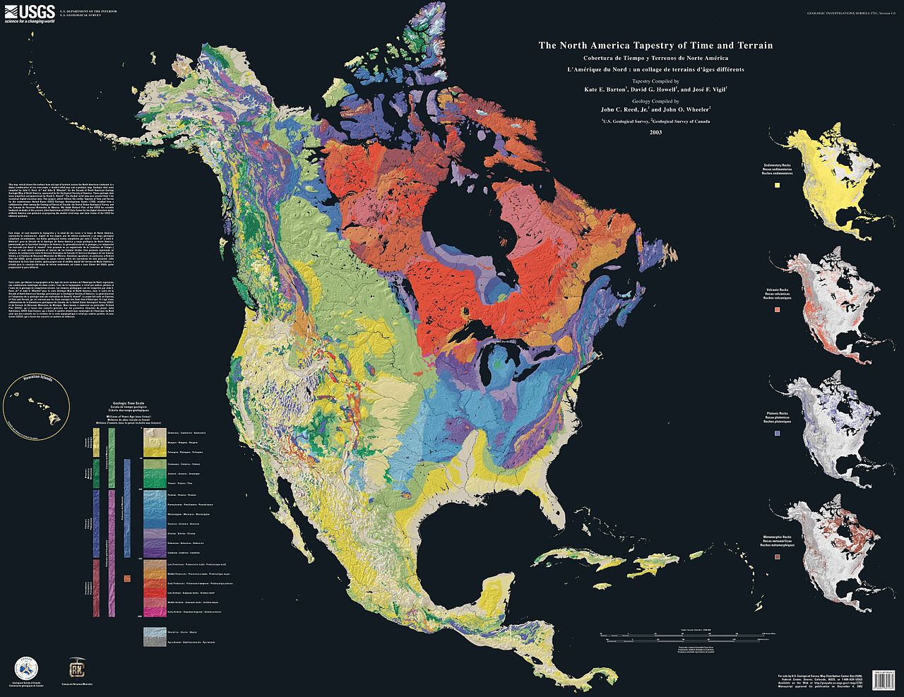
The North America Tapestry of Time and Terrain (1:8,000,000 scale) is a product of the United States Geological Survey in the I-map series (I-2781). This map was prepared in collaboration with the Geological Survey of Canada and the Mexican Consejo Recursos de Minerales.
This cartographic tapestry is woven from a geologic map and a shaded relief image. This digital combination reveals the geologic history of North America through the interrelation of rock type, topography and time. Regional surface processes as well as continent-scale tectonic events are exposed in the three dimensions of space and the fourth dimension, geologic time. The large map shows the varying age of bedrock underlying North America, while four smaller maps show the distribution of four principal types of rock: sedimentary, volcanic, plutonic and metamorphic.
Related images
Four maps show the North American distribution of four principal types of rock: sedimentary, volcanic, plutonic and metamorphic.


There are separate images of the main map, time scale, and rock type maps.
-
 North American terrain
 -
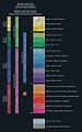 Time scale
 -
 North American rock types


Source
This image is in the public domain in the United States because it only contains materials that originally came from the United States Geological Survey, an agency of the United States Department of the Interior. For more information, see the official USGS copyright policy.
|
Home: http://pubs.usgs.gov/imap/i2781/
Image: http://pubs.usgs.gov/imap/i2781/i2781_c_low.pdf 144 dpi, encoded to 72 dpi JPEG, compressed slightly to fit within Wikipedia 2MB limit.
Source: English Wikipedia, original upload 15 April 2005 by SEWilco
File history
Click on a date/time to view the file as it appeared at that time.
| Date/Time | Thumbnail | Dimensions | User | Comment | |
|---|---|---|---|---|---|
| current | 16:04, 16 September 2005 | | 3,790 × 2,922 (1.9 MB) | Saperaud~commonswiki | The North America Tapestry of Time and Terrain (1:8,000,000 scale) is a product of the United States Geological Survey in the I-map series (I-2781). This map was prepared in collaboration with the Geological Survey of Canada and the [[Mexican |
File usage
The following page uses this file:
Global file usage
The following other wikis use this file:
- Usage on de.wikipedia.org
- Usage on en.wikipedia.org
- Usage on fa.wikipedia.org
- Usage on ja.wikipedia.org
- Usage on www.wikidata.org