File:LocationDominicanRepublic.png
No higher resolution available.
LocationDominicanRepublic.png (250 × 115 pixels, file size: 5 KB, MIME type: image/png)
| This is a file from the Wikimedia Commons. The description on its description page there is shown below.
Commons is a freely licensed media file repository. You can help. |
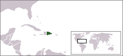
Location map for the Dominican Republic.
Originally created for English Wikipedia by Vardion.
| |
This work has been released into the public domain by its author, Vardion, at the English Wikipedia project. This applies worldwide. In case this is not legally possible: |

|
File:LocationDominicanRepublic.svg is a vector version of this file. It should be used in place of this PNG file when not inferior.
File:LocationDominicanRepublic.png → File:LocationDominicanRepublic.svg
For more information, see Help:SVG. |
 |
File history
Click on a date/time to view the file as it appeared at that time.
| Date/Time | Thumbnail | Dimensions | User | Comment | |
|---|---|---|---|---|---|
| current | 02:39, 20 December 2004 | | 250 × 115 (5 KB) | EugeneZelenko | Location map for the Dominican Republic.<br/>Originally created for English Wikipedia by Vardion.<br/>{{PD}}<br/>Category:Country locator maps |
File usage
The following page uses this file:
Global file usage
The following other wikis use this file:
- Usage on ar.wikipedia.org
- Usage on beta.wikiversity.org
- Usage on be.wikipedia.org
- Usage on bg.wikipedia.org
- Usage on bpy.wikipedia.org
- Usage on br.wikipedia.org
- Usage on de.wikipedia.org
- Usage on de.wiktionary.org
- Usage on el.wiktionary.org
- Usage on en.wikipedia.org
- Usage on en.wikivoyage.org
- Usage on en.wiktionary.org
- Usage on eo.wikipedia.org
- Usage on es.wikipedia.org
- Usage on eu.wiktionary.org
- Usage on frp.wikipedia.org
- Usage on fr.wikipedia.org
- Usage on he.wikivoyage.org
- Usage on hr.wikipedia.org
- Usage on ht.wikipedia.org
- Usage on hy.wikipedia.org
- Usage on incubator.wikimedia.org
- Usage on it.wikinews.org
- Usage on it.wikivoyage.org
- Usage on ja.wiktionary.org
- Usage on kbd.wikipedia.org
- Usage on ko.wikipedia.org
- Usage on ko.wiktionary.org
- Usage on la.wiktionary.org
- Usage on lij.wikipedia.org
- Usage on li.wikipedia.org
- Usage on lt.wiktionary.org
- Usage on nds-nl.wikipedia.org
- Usage on new.wikipedia.org
- Usage on nl.wikipedia.org
View more global usage of this file.